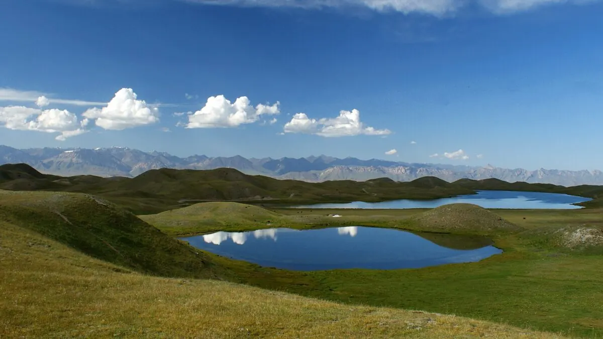
Pik Lenin fills the whole southern horizon, a 7,134 m wall of ice above a valley of grass and grazing horses. The same Pamir-Alay high country holds Abramov, Central Asia’s best-measured glacier.
The Heights of Alay is a three-to-four-day trek through the meadows and yurt camps of the Alay valley, starting from the village of Sary-Mogol and looping around the Tulpar-Kul lakes beneath Pik Lenin. It is moderate rather than technical (long days and real altitude, but no ropes or scrambling) and it's the best walking introduction to the big peaks of southern Kyrgyzstan. The season is July to September, and it starts a half-day’s drive from Osh.
This is nomad country, not a national-park circuit. You sleep in homestays and yurt camps, share the trail with herders moving animals to summer pasture, and top out on passes with one of the most accessible 7,000 m peaks on Earth in full view. For where it sits among the country’s routes, see our roundup in the trekking guide.
Getting to Sary-Mogol
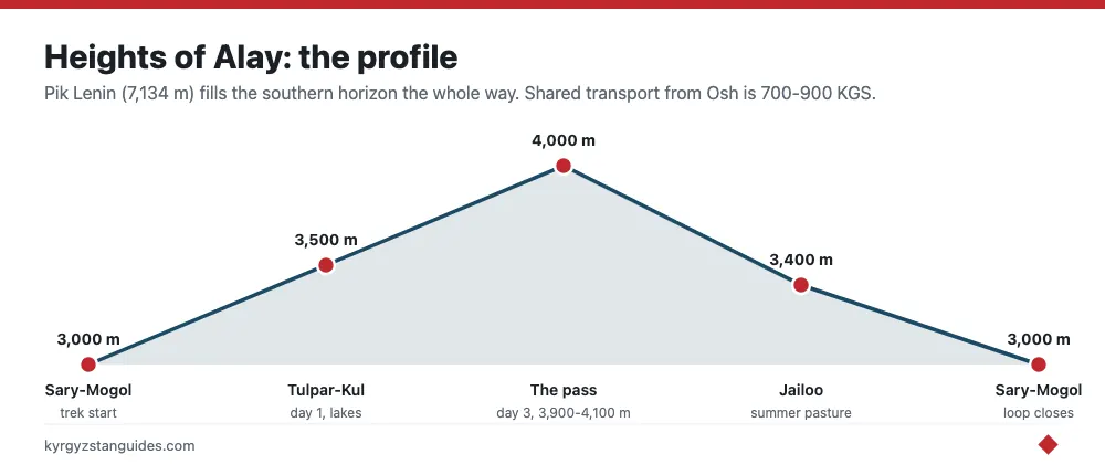
The trek begins in Sary-Mogol, a small village in the Alay valley at about 3,000 m. From Osh it's roughly four to five hours by road, following the same highway used for the Pamir before it branches west off the Sary-Tash junction. Shared transport from Osh runs around 700– 900 KGS a seat, or you can arrange a private car through a guesthouse. There is a CBT (Community-Based Tourism) office in Sary-Mogol that fixes homestays, guides, horses and the border-zone permit — book with them a day or two ahead.
The border-zone permit
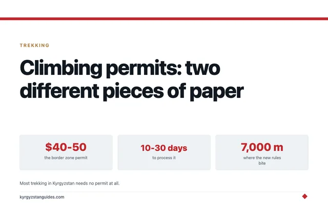
The Alay valley runs close to the Tajik border, and parts of the trekking area fall inside a controlled border zone. That means you may need a border-zone permit, which the CBT office or your operator arranges with a couple of days’ notice using your passport details. It's inexpensive but not instant, so don’t leave it to the morning you want to start walking. Requirements shift with the security situation on the Tajik side, so confirm the current rule when you book rather than assuming.
The route, day by day
The classic loop is three nights and four days, though shorter three-day and longer five-to-six-day variants exist. This is the common version.
Day 1: Sary-Mogol to Tulpar-Kul
A steady climb out of the valley toward the cluster of small lakes known as Tulpar-Kul, at around 3,500 m, near the Pik Lenin base camp at Achik-Tash. It is a manageable first day but you are already high, so take it slow. Camp or stay in a yurt by the lakes, with the peak reflected in the water on a still evening.
Day 2: Tulpar-Kul and the Pik Lenin viewpoints
A day among the moraines and viewpoints above base camp, walking up toward the so-called Traveler’s Pass and the ridges that frame Pik Lenin. This is the acclimatization and scenery day, short on distance, long on views, and a good chance to watch climbers and horse caravans moving toward the higher camps.
Day 3: Over the pass to the jailoo
The biggest day: a climb over a pass around 3,900– 4,100 m and down into open summer pasture, the jailoo, where herder families camp with their animals. Expect a long stretch above 3,500 m, some exposure to wind, and the payoff of grassland stretching to the horizon under the ice peaks.
Day 4: Return to Sary-Mogol
A descent back through the meadows to the village, closing the loop. Many trekkers arrange a car to be waiting for the drive back to Osh, or continue toward Sary-Tash to link up with the Pamir route.
Variants stretch this to five or six days by adding side valleys, extra passes and more nights on the jailoo, which is worth it if you want to slow down and spend real time with herder families rather than march the loop. A shorter three-day version cuts the acclimatization day, but we would not recommend that unless you have already been at altitude, because the pass on day three is where altitude problems tend to surface.
Guide or independent?
You can walk the Alay independently if you're experienced with navigation and altitude, but two things push most people toward a local guide here: the border-zone permit, which a guide or CBT office handles for you, and the sheer remoteness, there is no rescue infrastructure and little phone signal, so a mistake is costly. A guide-horseman also carries your pack, reads the weather, and doubles as an introduction to the herder families whose pastures you cross, which is much of the point of coming this far south.
Difficulty and altitude
Fitness-wise this is a moderate trek that a regular hiker can handle, but the altitude is the real test. You're consistently above 3,000 m and cross passes near 4,000 m, so acute mountain sickness is possible, especially if you come straight from low-lying Osh. Build in the acclimatization day at Tulpar-Kul, drink plenty of water, and don’t schedule this as your first activity in the country. The nearby Pik Lenin base camp trek shares the same terrain and altitude profile if you want to go higher.
Season and costs
The window is July to September, with August the most reliable for open passes and running yurt camps; snow can linger on the high pass into early summer and returns by autumn. For the country-wide picture, see the best time to visit. Costs are low: budget roughly $10– 15 a night for homestays and yurtstays with meals, about $30– 40 a day for a guide, and $15– 20 a day to hire a horse for yourself or your packs. A guided, all-in three-to-four-day trip arranged through CBT typically lands in the low hundreds of dollars per person including transport from Osh.
What to bring
This is a self-supported-feeling trek even when guided, so come prepared for cold, sun and remoteness. Nights at the lakes drop below freezing well into summer, and the passes are exposed to wind and afternoon storms.
- A sleeping bag rated to around -5°C plus an insulating mat, even if using yurts.
- Waterproof jacket and warm layers; weather flips fast above 3,500 m.
- Broken-in boots and trekking poles for the pass day.
- Strong sun protection — the high-altitude sun is fierce on snowfields and grass alike.
- All the cash you need, since there's nothing to buy past Sary-Mogol.
- Any altitude medication and a small personal first-aid kit.
Combine it with the Pamir or Pik Lenin
The Heights of Alay is a long way south, so it pays to build a trip around it rather than treat it as a standalone. It shares a road and a base area with the Pik Lenin climb, so a natural add-on is a couple of extra nights at Tulpar-Kul to watch the mountaineering scene at Achik-Tash. It also branches off the same route as the Pamir Highway into Tajikistan, so ambitious travelers trek the Alay first, then continue south from Sary-Tash over the Kyzyl-Art pass toward Murghab. If your visit is short and northern-focused, though, be honest with yourself, the journey down here only makes sense if you can give it several days.
Frequently Asked Questions
How hard is the Heights of Alay trek?
Moderate. It's non-technical, no ropes or scrambling: but you walk long days and cross passes near 4,000 m, so altitude is the main challenge. A reasonably fit hiker who acclimatizes properly at Tulpar-Kul can complete it comfortably in three to four days.
Do I need a permit for the Alay valley?
Often, yes. Parts of the trekking area lie in a border zone near Tajikistan and need a border-zone permit, arranged by the Sary-Mogol CBT office or your operator a couple of days ahead using your passport. Confirm the current requirement when you book, as rules change.
When is the best time to trek Heights of Alay?
July to September, with August the safest bet. The high pass can hold snow into early summer and yurt camps close for winter, so the core season is short. Come in high summer for open passes, running homestays and the best chance of clear views of Pik Lenin.
How do I get to Sary-Mogol from Osh?
Roughly four to five hours by road, following the Pamir highway before it branches west off the Sary-Tash junction. Shared transport runs around 700–900 som a seat, or a guesthouse can arrange a private car. Sary-Mogol sits at about 3,000 metres.
How much does the Heights of Alay trek cost?
Budget roughly $10–15 a night for homestays and yurt stays with meals, about $30–40 a day for a guide, and $15–20 a day to hire a horse. A guided all-in three-to-four-day trip through CBT typically lands in the low hundreds of dollars per person including transport from Osh.
Can I trek the Alay valley without a guide?
You can if you are experienced with navigation and altitude, but two things push most people toward a local guide: the border-zone permit, which the CBT office handles, and the remoteness. There is no rescue infrastructure and little phone signal, so a mistake is costly.
How high does the Heights of Alay trek go?
You are consistently above 3,000 metres, camp at Tulpar-Kul around 3,500 metres, and cross a pass of roughly 3,900–4,100 metres on the third day. That pass is where altitude problems tend to surface, which is why the acclimatisation day should not be skipped.