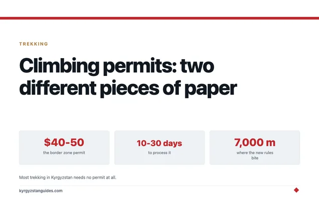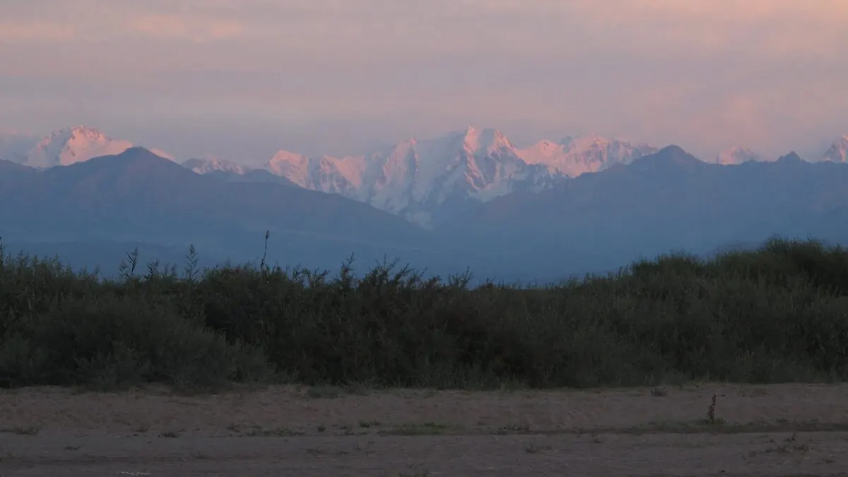
Is the Boz-Uchuk lakes trek worth doing instead of Ala-Kul? Honestly, yes, if solitude matters more to you than the postcard. The lakes sit at roughly 3,400–3,500 m in the Terskey Ala-Too east of Karakol, take two to three moderate days from either Boz-Uchuk village or Jyrgalan, and cost almost nothing: no permit, no entrance fee, no crowds to plan around.
The lakes fill a broad glacial cirque ringed by scree and snow-streaked ridges, three lakes in all, two sharing the south-western bowl and a smaller one in the north-eastern bowl. On a July day when the Ala-Kul trail is carrying hundreds of trekkers, you might pass a handful of hikers and a few shepherds here. The catch, and there's one, is that the trail is faint and braided in places. This is a trek for people comfortable with basic navigation, not complete first-timers.
The honest comparison with Ala-Kul
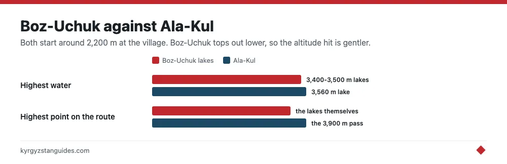
The Ala-Kul lake trek is spectacular, and precisely for that reason it is busy: in high summer you share the campsites and the 3,900 m pass with a small army. Boz-Uchuk tops out lower, the lakes at 3,400–3,500 m against Ala-Kul’s 3,560 m lake and 3,900 m pass, so the altitude hit is gentler, and it works as a standalone out-and-back or as part of a longer loop. It is also less dramatic; there's no glacier-fed turquoise showpiece at the end. If you want the icon, do Ala-Kul. If you want the Terskey without the tent city, come here.
Two ways in
From Boz-Uchuk village, the direct way. The village sits near the Issyk-Kul shore roughly halfway between Karakol and Jyrgalan, and a rough track leads up the valley; a 4WD or a horse can skip the dull lower section. Count on 5–7 hours to the lower lake, a night camping by the water, and an easier walk out the next morning. Two days, minimum fuss.
From Jyrgalan. The scenic loop. Approaching over the passes and jailoo (summer pastures) to the east turns this into a three-day trek with bigger views and links it into the Keskenkija loop, Jyrgalan’s signature multi-day circuit of waterfalls, passes, and alpine valleys. The village’s community tourism association maintains marked trails and arranges guides, horses, and yurt stays — the friendliest option if the route-finding worries you.
Either way, stage out of Karakol. It has the guesthouses, gear shops, and marshrutkas you need.
Sleeping up there
This is a camping trek at heart. Wild camping beside the lakes is free and unrestricted, flat pitches and fresh water are easy to find, and falling asleep alone at 3,500 m with the water going glassy at dusk is the whole point. Bring a stove; there's no reliable firewood at that altitude. In July and August, seasonal yurts and shepherd camps appear on the lower pastures, some will sell you tea, kymyz, or a bed, but never count on them being there. On the Jyrgalan side you can pre-book yurt camps through the village association and carry less. If sleeping under felt is new to you, our yurt stay guide covers what to expect.
Navigation is the crux
The climb itself is a steady, non-technical grind from about 2,200 m at the village to the lakes. What bumps this trek above easy is everything around the climb: the path fades and braids where it crosses pastures and moraine, there are no facilities and no rescue on tap, and phone signal is patchy at best. Download the route to Maps.me or Organic Maps before leaving Karakol and cross-check it against a GPS track — crowd-sourced trails here can be approximate. The valley funnels you upward, but the exact line is easy to lose.
Not confident reading terrain? Hire a guide in Karakol or through Jyrgalan. On a trail this quiet, it's cheap insurance.
Costs, season, and what to carry
With no fees of any kind, your money goes on transport and optional help. A marshrutka or taxi from Karakol to Boz-Uchuk village runs 150–800 KGS ($2–9); the marshrutka to Jyrgalan is 150–250 KGS. A guide costs 3,000–4,500 KGS ($34–51) per day, a pack or riding horse 1,500–2,500 KGS ($17–28), and a yurt night with full board 2,000–3,000 KGS ($23–34). A self-supported two-day trip can cost little more than the bus fare and your food. Comfortably inside any Kyrgyzstan travel budget. Figures are 2026 rates at roughly 88 KGS to the dollar; most visitors enter visa-free, but confirm your status on the Kyrgyz e-visa portal.
Go between mid-June and mid-September. July and August are safest for snow-free ground and open pastures; early June can still hold snow near the lakes, and by late September nights freeze hard and the shepherds leave the jailoo. Afternoon thunderstorms are routine in high summer, start early and be off exposed ground by mid-afternoon. Our Kyrgyzstan trekking guide sets this season against the region’s other routes.
Pack for full self-sufficiency: tent, stove and fuel, a sleeping bag rated to at least -5°C (nights are cold even in July), a water filter (the streams look clean but animals graze upstream), serious sun protection for the high-UV cirque, and food for every planned day plus one spare in case weather pins you down. Karakol’s outdoor shops cover last-minute gaps; the full checklist is in our Kyrgyzstan packing list. One last warning: nobody is watching this valley. Leave your plan with your guesthouse before you walk out of signal.
The route numbers don't agree, and that matters for planning
Two published versions of this trek exist and they differ by half. Destination Karakol, the local destination management organisation, lists it at 63 km over three days, maximum elevation 3,478 m, minimum 2,128 m, season June to September, medium difficulty. An independent route guide measures the same trek at 42 km, split 13.5, 14.5 and 14 km across the three days.
Both are describing the Boz-Uchuk lakes. The gap is almost certainly where each one starts and stops counting, and the practical lesson is to ask your guide or guesthouse which version they mean before you agree a daily pace. A 21 km difference across three days is the difference between a comfortable walk and a long one.
The passes are better agreed: Terim-Tor Bulak at 3,467 m and Boz-Uchuk Ashuu at 3,363 m, with the lakes themselves in the 3,450-3,478 m band. Jyrgalan, the usual trailhead, is about 90 minutes from Karakol by marshrutka. Snow is possible at lake altitude in any month, and the higher neighbouring Ak-Suu routes, topping out near 3,980 m, are listed July to September only, which tells you how narrow the genuinely clear window is up here.
You are walking through a range that is measurably shrinking
The Terskey Ala-Too runs roughly 375 to 400 km and carries somewhere around 1,375 glaciers covering about 1,124 km², with 757 of them and 544 km² on the northern, Issyk-Kul-facing side. That is the ice feeding the streams you will cross.
It is going. Kutuzov and Shahgedanova mapped 335 glaciers in the eastern Terskey-Alatoo for Global and Planetary Change in 2009 and found the glaciated area down 19% on its mid-19th-century extent by 2003, a loss of 76 km². For the 109 glaciers they could compare against 1965 topographic maps, 12.6% of the 1965 area had gone by 2003. Retreat was slow early in the 20th century, quickened between 1943 and 1956, quickened again after 1977, and has been faster since 1990 than at any point since the Little Ice Age. Ablation-season temperatures at regional stations have risen 0.02-0.03 °C a year since the 1950s.
The western end of the range tells the same story from different data. Narama and colleagues compared 1971 Corona satellite imagery with Landsat in 2002 across 269 glaciers and found 18.4 km² gone, 8% of the 1971 coverage in thirty years, with small glaciers under 1 km² accounting for 38% of the total loss. The little ones go first, and the little ones are the ones above lakes like these.
FAQ
How long is the Boz-Uchuk lakes trek?
Sources disagree. Destination Karakol lists 63 km over three days; an independent guide measures the same route at 42 km. Confirm which version your guide or guesthouse is working to before you agree a daily distance.
How high are the Boz-Uchuk lakes?
Between about 3,450 and 3,478 metres, in the Terskey Ala-Too east of Karakol. The route crosses Terim-Tor Bulak at 3,467 m and Boz-Uchuk Ashuu at 3,363 m.
How many Boz-Uchuk lakes are there?
Three. Two share the south-western bowl and a smaller one sits in the north-eastern bowl. Per-lake elevations have not been published; the 3,450-3,478 m figure covers the whole basin.
When is the season for the Boz-Uchuk trek?
June to September, with July and August the safest bet. Snow is possible at lake altitude in any month, and neighbouring higher routes are rated July to September only.
Is Boz-Uchuk better than Ala-Kul?
Different, not better. Boz-Uchuk is lower, quieter and needs no permit or fee, but the trail is faint and braided in places and navigation is the real difficulty. Ala-Kul is the postcard and comes with the crowds that implies.
Do you need a permit for the Boz-Uchuk lakes?
No. There is no permit and no entrance fee. The trailhead at Jyrgalan is about 90 minutes from Karakol by marshrutka.