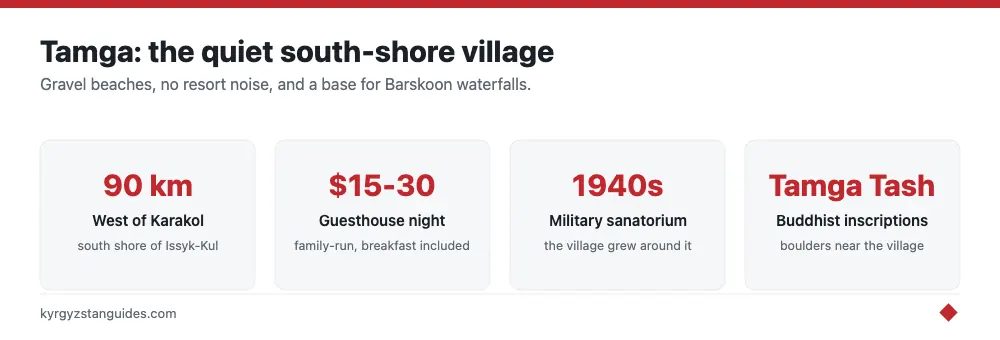
Tamga is a small, leafy village on the south shore of Lake Issyk-Kul, about 90 km west of Karakol, built around a military sanatorium founded in the 1930s and best used as a calm beach base and the launch point for the Barskoon valley waterfalls. It has quiet gravel beaches, the Tamga Tash Buddhist inscription boulders, guesthouses at $15-30 a night, and almost none of the noise of the north-shore resorts.
If the pumping speakers and paddle-boats of Cholpon-Ata are the opposite of what you want, this is the correction. Tamga trades nightlife and water slides for apricot orchards, a slow pace, and a lake that most days you have close to yourself. We rate it as the south shore’s most relaxing single stop.
A Sanatorium Village With a WWII Backstory
Tamga owes its existence to the Tamga Sanatorium, and the usual telling of its origin is a decade out. A rest house on this stretch of shore was ordered built in 1931 by the commander of the Turkestan Military District; it later became a Ministry of Defence sanatorium. The wartime connection is real but narrower than the legend: the official Kyrgyz heritage portal records that wounded officers from the front were treated and rehabilitated here during the Second World War. It was not purpose-built for air-force pilots. The story that cosmonauts convalesced here after missions is repeated locally; take it as village lore rather than hard record, but the leafy grounds, old Soviet-era buildings, and long shaded avenues are real and give the place its unhurried, out-of-time feel.
The sanatorium still operates as a spa-style rest house, and its grounds run down to one of the better stretches of beach. Non-guests can usually walk in or pay a small fee to use the beach area. Around it, the village itself is a grid of quiet lanes under poplars and fruit trees, with a couple of shops, a bakery, and family guesthouses that fill only lightly even in July.
Tamga Tash: Buddhist Stones in the Grass
The village’s genuine curiosity is Tamga Tash. A scatter of large boulders carved with the Tibetan Buddhist mantra Om mani padme hum, whose date is genuinely disputed, by centuries rather than decades. “Tamga” itself means a seal or brand-mark, and that is essentially what these are: sacred marks left in stone.
The inscribed boulders sit up the Tamga river gorge, in the hills about 5 km south of the village and several hundred metres apart. There is no ticket booth and no signage to speak of, which is part of the charm and also the frustration — ask at your guesthouse for the path, or agree a taxi-and-wait. On foot it is a round trip of about 10 km with a climb of roughly 200 m, so treat it as a half-day walk rather than a stroll. Do not expect a grand monument; expect weathered script on boulders in the hills, which for the right traveler is exactly the appeal.
The Beaches
Tamga’s shoreline is gravel and coarse sand rather than the finer sand of the north, and the water is famously clear and, in high summer, swimmable — Issyk-Kul is slightly saline and never fully freezes, but it only warms up enough for comfortable swimming from roughly July into early September. The beaches here are undeveloped: no loungers for hire, no jet-skis, just space. Bring your own shade and water. A knock-on benefit of the quiet is the night sky — with no resort glare, the stars over the lake are genuinely good on a clear evening, which isn't something you can say on the built-up north shore. For a broader look at the lake’s two very different shores, our Issyk-Kul lake guide lays out where each type of traveler should base.
Base for Barskoon and the High Road
The strongest reason to sleep in Tamga rather than pass through is the Barskoon valley, which opens into the mountains just to the east. Barskoon is known for a series of waterfalls — including one nicknamed for Yuri Gagarin, and for a dramatic switchback mining road that climbs to high alpine pastures and the Arabel plateau above 3,500 m, with lakes and, in season, edelweiss. A half-day taxi from Tamga up to the main falls is the easy version; the full climb to the plateau needs a sturdy vehicle and a driver who knows the road. Further east along the same shore, beyond Barskoon, the Chon-Kyzyl-Suu valley holds a research station that has taken meteorological observations on the northern slope of the Terskey Ala-Too continuously since 1948.
Tamga also sits on the through-route between the beach towns and the southern lakes, making it a natural pause. It pairs well with a run out to the Skazka (Fairytale) Canyon further east along the shore, and it is an easy hop from Bokonbaevo, the south shore’s eagle-hunting and yurt-culture hub.
Getting There and Sleeping
South-shore marshrutkas running between Balykchy, Bokonbaevo, and Karakol pass the Tamga turn-off; ask to be dropped and walk in, or take a shared taxi. From Karakol it's about a 90-minute drive; from Bishkek, budget a long half-day via Balykchy. Guesthouses cluster near the sanatorium and along the main lane, mostly family-run at $15-30 including breakfast, often with dinner on request, worth taking, as eating options in the village are thin. Cash only; the nearest reliable ATMs are back in Karakol or Bokonbaevo, so draw som before you arrive. Mobile signal is fine in the village but fades quickly up the Barskoon valley, so download offline maps if you plan to head into the mountains.
Is Tamga Worth It?
For a beach party, no. Go north to Cholpon-Ata. But for one or two slow days of clear water, orchard shade, an odd set of Buddhist stones, and a springboard into the Barskoon mountains, Tamga is one of the most restful stops on the whole lake. Come for the quiet, stay for Barskoon, and don’t expect anything to happen in a hurry.
How old are the Tamga Tash stones, really?
Most write-ups give you a confident answer. There isn't one. Two datings are in circulation and they are eight hundred years apart.
The older reading puts the carving in the 8th to 9th centuries, when Buddhism was moving along the Tian Shan trade branches and this shore sat on a working route. The competing reading assigns the stones to the Oirat-Dzungar period, roughly the 15th to 19th centuries, when Dzungar Buddhists were active across the Issyk-Kul basin. A 2025 paper in Teoriya i praktika arheologicheskih issledovanij by Hermann, Soronkulov, Delwiche and Asein Uulu, working on newly recorded Tibetan inscriptions at Ala-Bel, dates Tibetan om mani padme hum graffiti in this region to the Oirat-Dzungar period. That is the most recent specialist view, and it pushes the stones a great deal closer to the present than the guidebook version.
What is not in dispute: there are three inscribed granite boulders, several hundred metres apart, in the hills about 5 km south of the village at roughly 1,878 m. The main stone carries the full mantra in Tibetan script. A third carries only the syllable om. Nobody has published a proper survey, so whether three is the true count is an open question, and at least one account suggests more may be out there.
None of this makes them less worth the walk. It does mean that if a driver tells you they are twelve hundred years old, he is repeating one of two possible answers as though it were the only one.
The mud is the point, not the beach
The sanatorium sits at about 1,684 m, and its actual medical resource has nothing to do with the lake you swim in. The treatment material is sulphide mud from Ak-Chiy Bay, roughly 8 km west of the village, with recorded reserves of about 40,900 tonnes. That is what the institution was built around, and it is why a military rest house ended up on this particular stretch of an eight-hundred-kilometre shoreline rather than a prettier one.
The orchards are the other thing people underrate. Saruu and Kichi-Jargylchak, the villages either side of Tamga, carry hundreds of hectares of apricot and apple trees across about five varieties, including korolevsky and krasnoshchyoky. A typical two-hectare plot holds around 450 apricot trees and has produced as much as 15 tonnes in a good year, and regional collection points moved 745 tonnes over 2013 to 2015. Late July into August is when that is visible from the road, and it is the one time of year the south shore smells of something other than lake and diesel.
FAQ
What are the Tamga Tash stones?
Three inscribed granite boulders in the hills about 5 km south of Tamga village, at roughly 1,878 m. The main one carries the Tibetan Buddhist mantra om mani padme hum; a third carries only the syllable om. "Tamga" means a seal or brand-mark, which is essentially what they are.
How old are the Tamga Tash inscriptions?
Disputed, and by centuries. One reading puts them in the 8th to 9th centuries; a 2025 specialist paper on Tibetan inscriptions in the region assigns this type of carving to the Oirat-Dzungar period, roughly the 15th to 19th centuries. Treat any single confident date with suspicion.
Was the Tamga sanatorium built for Soviet pilots?
No. A rest house here was ordered built in 1931 by the commander of the Turkestan Military District and later became a Ministry of Defence sanatorium. During the Second World War it treated wounded officers from the front. The air-force and cosmonaut versions are local retellings, not record.
Did cosmonauts really recuperate at Tamga?
It is widely repeated locally and appears on Kyrgyz tourism portals, but no primary or archival source confirms it. Enjoy it as village lore. Don't plan a trip around it.
Is Tamga a good base for Issyk-Kul's south shore?
Yes, if quiet is what you want. It is about 90 km west of Karakol at roughly 1,685 m, with gravel beaches, guesthouses around $15-30, and easy access to the Barskoon valley. For nightlife and water slides you want Cholpon-Ata on the north shore instead.
When are the Tamga apricots ripe?
Late July into August. The orchards belong mostly to Saruu and Kichi-Jargylchak on either side of the village, running to hundreds of hectares across about five varieties.