On a Tien Shan trek you will cross slopes of loose rubble that seem to have flowed downhill and then stopped, with a steep tongue-shaped front and a surface of ridges and furrows like a tarpaulin pushed from behind. It looks like landslide debris. It is not. It is a glacier, and most of what you are walking on is ice.
Rock glaciers are the least-discussed part of the Kyrgyz cryosphere and, as the white ice retreats, arguably the most important.
What they actually are
The technical definition is cryospheric landforms formed by the gravity-driven creep of accumulations of rock debris supersaturated with ice. In plain terms: ice and rock mixed together, moving downhill like extremely slow treacle.
The difference from a clean-ice glacier is the debris cover, and it matters more than it sounds. An active layer of half a metre to five metres of rock insulates the ice beneath it, slowing melt dramatically. That makes rock glaciers climatically far more resilient than glaciers, responding to warming over much longer timescales.
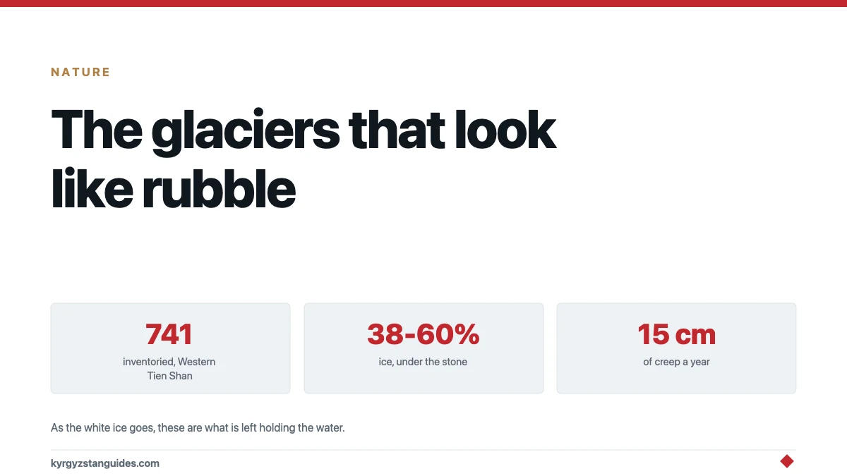
How much ice is actually in there has been measured rather than guessed. A study across ten sites in the Tien Shan and Pamir, in Kyrgyzstan and Tajikistan, between 3,100 and 4,580 metres, used twenty-two electrical resistivity and refraction seismic profiles. Rock glaciers came out at 38 to 60% ice — the highest of any landform surveyed. Moraines ran 18 to 40%, talus slopes 20 to 40%, fine-grained sediments 0 to 20%. Ice content tracks the landform type more than the geography.
How many, and the number you should not repeat
The first rock glacier inventory for the Western Tien Shan, covering Kazakhstan and Kyrgyzstan, counted 741 rock glaciers over more than 70.5 square kilometres: 509 active and 232 transitional, with mean seasonal displacement of about 15 centimetres a year measured by satellite radar in August and September.
They sit mainly between 2,800 and 3,800 metres, with a mean of 3,340 m, and more than two-thirds of the total area is on north-facing slopes — which is exactly where you would expect ice to survive.
Now the caveat, because this gets misquoted constantly. That 741 is Western Tien Shan across two countries. It is not a Kyrgyzstan figure. The wider regional count of 2,187 rock glaciers holding 4.08 gigatonnes of water is for all of Central Asia as a statistical region. No Kyrgyzstan-only count exists that I could find, and anyone quoting one is extrapolating.
Why they matter as the white ice goes
Globally, more than 51,000 rock glaciers have been identified, holding water equivalent to about 62 gigatonnes. The ratio of rock glacier to glacier water is roughly 1:2,226 worldwide, but 1:618 once you exclude the polar and data-poor regions. For Central Asia specifically it is 1:904.
Those ratios sound like rock glaciers are a rounding error. The point is what happens over time. The Terskey Ala-Too’s clean-ice glaciers have lost 19% of their Little Ice Age extent by 2003, and the loss has accelerated since 1990. Rock glaciers, insulated under their rubble, are not doing that. As the exposed ice disappears, the debris-covered ice becomes a proportionally larger share of what is left. The researchers who built the Western Tien Shan inventory describe them as climatically resilient water reservoirs in arid mountains, and that is the whole argument in one phrase.
The same study identified the paper's own frustration: Central Asia is critically data-deficient, and the authors call it the most pressing need for future inventory work. There is a UNESCO and GEF cryosphere project dataset for the Pamir and southern Issyk-Köl sector, published open-access in January 2026, which is the start of fixing that.
How to recognise one on the ground
You do not need instruments to tell a rock glacier from a scree slope, and once you have seen the difference you will spot them repeatedly.
A talus or scree slope is a cone of debris that fell and stopped. A rock glacier has flowed, and it looks like it: the surface carries transverse ridges and furrows, like the skin on cooling custard or a tarpaulin pushed from one end, because the ice beneath is moving faster in the middle than at the margins. The front is the other giveaway — a steep, over-steepened tongue, often at the angle of repose and often paler where fresh material is spilling down it.
Movement is slow enough to be invisible: the Western Tien Shan inventory measured mean seasonal displacement at about 15 centimetres a year. You are not going to watch it happen. But the landform records the motion.
The inventory also sorts them into active and transitional — 509 and 232 respectively in that survey. Active ones still contain ice and still creep. Transitional ones are losing both. There is no visual shorthand that reliably separates the two from a trail, which is part of why the category exists.
Why so little is known, and what is being done
For a country whose water supply is a mountain cryosphere, the data gap here is striking. The global study that produced the 51,000-plus count flags Central Asia as critically data-deficient and names it the most pressing need for future inventory work. The first Western Tien Shan rock glacier inventory only appeared in 2026.
That is now being addressed. A UNESCO and GEF cryosphere project for Central Asia published an open-access dataset in January 2026 covering rock glacier inventory and permafrost modelling inputs for the Pamir and the southern Issyk-Köl sector. It is the beginning of the picture rather than the picture.
For a visitor the practical consequence is modest but real: if you read a confident claim about Kyrgyz rock glaciers — a national count, a water volume, a named accessible example — it is almost certainly extrapolated from regional figures. The honest answer to most questions here is still that the survey has not been done. Our guide to Kyrgyzstan’s glaciers covers the clean ice, where the record is much better.
Permafrost, and what is not known
Rock glaciers are described by the inventory authors as key indicators of mountain permafrost, so the two questions go together. In the Western Tien Shan, modelling put the lower permafrost boundary at around 1,922 metres, with the largest and most active rock glaciers in the mid-range of permafrost probability. A separate prior estimate places the lower boundary of sporadic permafrost at 2,800 to 3,000 metres.
What nobody has published is a total permafrost area for the Kyrgyz Tien Shan, in square kilometres or as a share of national territory. The elevation thresholds are solid. The area is not.
Two more things I am going to decline to tell you, because the evidence is not there. I cannot point you to a rock glacier you can go and look at. No source states which are visible or reachable on a marked route. Ala-Archa is the plausible candidate given the research literature on its Aksay basin, and that is a guess, not a recommendation.
And rock glacier collapse is not a documented hazard here. The verified debris-flow hazard in the Kyrgyz Tien Shan is glacial lake outburst floods — 55 events in the northern Tien Shan between 1887 and 2020, peaking in the 1970s, all producing debris flows. That is a different mechanism. If you read that Tien Shan rock glaciers are destabilising and causing debris flows, that is not what the evidence shows.
FAQ
What is a rock glacier?
A landform of rock debris supersaturated with ice, creeping downhill under gravity. A layer of half a metre to five metres of rock insulates the ice beneath, which makes rock glaciers far more resilient to warming than clean-ice glaciers.
How much ice is in a rock glacier?
Between 38 and 60%, measured across ten sites in the Tien Shan and Pamir using resistivity and seismic profiling. That is the highest of any landform surveyed — moraines came out at 18-40% and talus slopes at 20-40%.
How many rock glaciers are there in Kyrgyzstan?
No Kyrgyzstan-only count exists. The first Western Tien Shan inventory found 741 across Kazakhstan and Kyrgyzstan together, and a regional figure of 2,187 covers all of Central Asia. Anyone quoting a national number is extrapolating.
Why do rock glaciers matter?
Because they keep their ice while exposed glaciers lose theirs. The Terskey Ala-Too's clean-ice glaciers have lost around a fifth of their Little Ice Age extent, while debris-insulated ice melts far more slowly, making rock glaciers a more durable water store in arid mountains.
Where is permafrost found in the Tien Shan?
Modelling in the Western Tien Shan put the lower permafrost boundary near 1,922 m, with a separate estimate placing sporadic permafrost at 2,800-3,000 m. No total permafrost area for the Kyrgyz Tien Shan has been published.
Can you see a rock glacier while trekking in Kyrgyzstan?
Probably, but no source names one that is visible or reachable from a marked route. Ala-Archa is the plausible candidate given the research on its Aksay basin, but that is an inference rather than a recommendation.