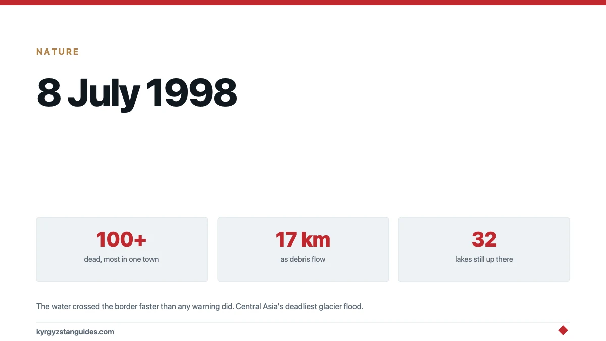
On 8 July 1998, a glacial lake in the Alay mountains of Kyrgyzstan burst and killed more than a hundred people — most of them downstream, across a border, in the Uzbek enclave of Shakhimardan. The study that finally reconstructed the event calls it the deadliest glacial lake outburst flood in Central Asia for at least the last hundred years.
Almost nobody has heard of it. There is no memorial literature in English, no anniversary journalism, and for two decades not even much science, because the valley it happened in is one of the most politically awkward places in the region: a Kyrgyz catchment draining into an island of Uzbekistan surrounded by Kyrgyz territory. The flood crossed a border on its way down. The warning did not.
What actually happened
The lake that failed sat high in the Shakhimardan catchment of the Alay range. It had a history, and the history is the unsettling part: it first appeared in the 1960s, drained itself periodically for years without hurting anyone, and by the late 1980s had apparently vanished. A lake that empties quietly several times teaches everyone downstream that lakes empty quietly.
Then came an unusually warm stretch in late June and early July 1998 — the kind of spell that accelerates melt and loads a glacial lake fast. On 8 July the lake burst. The reconstruction published in Science of the Total Environment traces what left the mountain: a debris flow that ran 17 kilometres, converting into a debris flood that ran another 20, with effects felt roughly 100 kilometres from the source.
Shakhimardan town — an Uzbek exclave popular then as now as a mountain resort, sitting at the junction of two rivers — took the worst of it. More than a hundred people died, most of them there.
And here is the detail that turns a natural disaster into something else: no warning passed between Kyrgyzstan and Uzbekistan. The water crossed the border faster than any information did. In 1998, relations between Tashkent and Bishkek were cold enough that even after the flood, researchers struggled for years to get access to the catchment from both sides.
How a glacial lake kills
It is worth being precise about the mechanism, because "flood" undersells it.
A lake like this one sits behind a dam nobody engineered: a moraine, the ridge of rock and rubble the glacier itself bulldozed into place, very often with buried ice still inside it. That ice melts. The dam settles, weakens, and develops internal channels, and a hot fortnight can push lake level and dam decay past each other's limits at the same moment. Failure, when it comes, is not a slow rise but a release — the lake can lose most of its volume in under an hour.
And what travels is not water. Moving down a steep channel, the surge tears up the valley floor and bulks itself with boulders, gravel and mud until it is a flowing mass denser than concrete slurry — a debris flow, which is what ran those first 17 kilometres. Debris flows do not drown people; they bury and demolish. Only lower down, as the gradient eases and the mass thins back toward muddy water, does it become the "debris flood" of the study's second 20 kilometres. A town at a river junction, like Shakhimardan, sits precisely where such a flow delivers everything it has gathered.
Numbers that circulate, and why this post does not use them
Accounts of the disaster sometimes carry much larger figures — hundreds missing, thousands evacuated, thousands of homes damaged on the Kyrgyz side. Those numbers may have roots in contemporaneous reporting, but I could not trace them to any source I could actually read, so they are not in this post. "More than 100 dead" is what the peer-reviewed reconstruction supports, and it is grim enough without decoration.
The lake came back
Post-event footage showed the basin refilled — to roughly 20,000 square metres — which is the plainest possible statement of the problem with glacial lakes: draining one solves nothing, because the glacier that made it is still there, still melting, still building the next one.
As of a 2018 inventory, the Shakhimardan catchment held 32 lakes totalling about 300,000 square metres, several of them classed as unstable. The catchment is still Kyrgyz, the town below is still Uzbek, and the physics has not changed. What has changed, slowly, is the politics: the 2017 thaw between the two countries reopened the kind of cross-border cooperation — and tourism to Shakhimardan itself — that was unthinkable when the flood hit.
Where this sits in Kyrgyzstan's wider flood problem
Kyrgyzstan's best-known outburst flood is Lake Merzbacher, which drains spectacularly most years and kills nobody, because it empties into an uninhabited glacier valley. Shakhimardan is the other face of the same mechanism: a smaller lake above a populated valley, which is the configuration that matters.
A database assembled for the northern Tien Shan — a different range from the Alay, so treat this as regional context rather than local — counts 55 glacial outburst events between 1887 and 2020, with a peak in the 1970s. The ingredients are everywhere in this country: retreating glaciers, new lakes forming behind unstable moraine, and villages built on the fans where mudflows have always run. What Shakhimardan adds to the standard story is the border: hazard maps stop at lines on the map, and water does not.
Visiting, and what to make of it
Shakhimardan today is reachable again and promoted on the Uzbek side as a resort, which it had been since Soviet times — it is the old mountain getaway of the Fergana valley, complete with a cable car and a famous blue lake, Kulikubbon, above the town. Most visitors have no idea the town is an exclave, let alone that the rivers running through it once arrived as a wall of debris.
If you go — it is one of the stranger day trips in the Fergana valley, passports required — the geography explains itself the moment you look up-valley: steep Kyrgyz mountains on every side, and the town pinned at the meeting of two channels that both begin in someone else's country. That is the whole story of 8 July 1998 in one view.
What I could not establish
A victim-by-victim or even a precise total death toll — "more than 100" is the supportable figure. The larger evacuation and damage numbers, as above. Whether any formal early-warning arrangement for this specific catchment exists today between the two states: monitoring of the lakes has resumed and been published, but I found no document describing an operational cross-border alert protocol, and given what happened in 1998, that absence is worth stating out loud.
FAQ
What happened at Shakhimardan in 1998?
A glacial lake in the Kyrgyz part of the Alay range burst on 8 July 1998, sending a debris flow 17 kilometres and a debris flood another 20, with effects felt about 100 kilometres downstream. More than a hundred people died, most in the Uzbek enclave of Shakhimardan, making it Central Asia's deadliest glacial lake outburst flood in at least a century.
Why did nobody warn the town?
The lake was in Kyrgyzstan and the victims were in an exclave of Uzbekistan, and in 1998 no warning passed between the two countries. Relations were cold enough that researchers also struggled for years afterwards to access the catchment, which is part of why the scientific reconstruction of the event only appeared in 2020.
Had the lake burst before?
It had drained before — harmlessly. The lake first appeared in the 1960s, emptied itself periodically without casualties, and seemed to have vanished by the late 1980s. A warm spell in late June and early July 1998 refilled and burst it. After the disaster, footage showed the basin had refilled again, to roughly 20,000 square metres.
Is the danger over?
No. A 2018 inventory counted 32 lakes in the Shakhimardan catchment totalling about 300,000 square metres, several of them unstable. The glacier that builds these lakes is still there, and the town is still downstream.
Where is Shakhimardan?
It is an exclave of Uzbekistan entirely surrounded by Kyrgyzstan's Batken region, in the Alay mountains south of the Fergana valley — a Soviet-era mountain resort then and now, reached by road from Fergana with border formalities on the way.
How does this compare with Lake Merzbacher?
Merzbacher is far bigger and drains most years, but into an uninhabited glacier valley, so it makes spectacle rather than casualties. Shakhimardan was the opposite: a small lake above a populated valley. The configuration, not the size, is what kills.
Can you visit Shakhimardan today?
Yes — the 2017 thaw between Uzbekistan and Kyrgyzstan reopened access, and the Uzbek side promotes it as a resort again, cable car and all. Take your passport: the day trip crosses international borders in both directions.