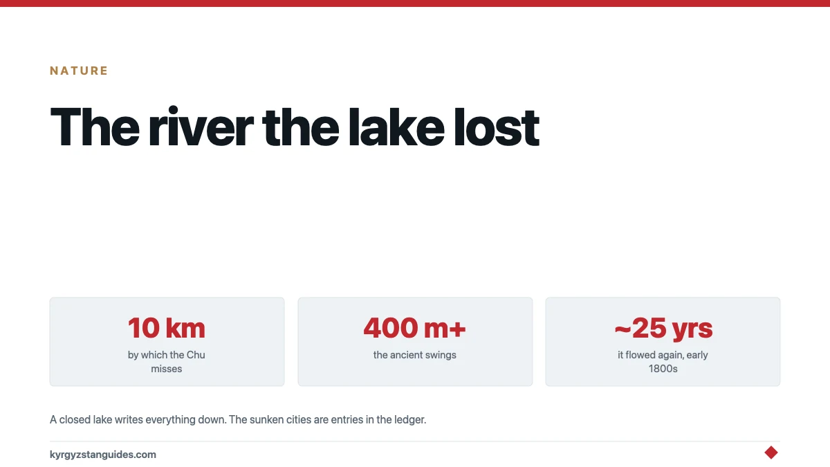
Issyk-Kul has no outlet. The Chu River — which by every visual logic should drain it — bends away just short of Balykchy and runs off through the Boom gorge without touching the lake. They miss each other by about ten kilometres.
It was not always so, and the story of when and how they parted is one of the best pieces of natural history in Kyrgyzstan: a lake that has swung through hundreds of metres of level change, drowned and exposed whole shorelines, and — within written history — briefly reached out and used its old river again. The sunken settlements along the north shore are one consequence; this post is about the mechanism underneath them.
The measured record: 1926 to now
Instrument records begin in 1926. From 1927 to 1997 the lake fell 3.4 metres; from 1997 to 2011 it rose 0.93; the surface sits near 1,607 metres above sea level. Diversion of inflowing rivers for irrigation gets most of the blame for the twentieth-century fall, climate the credit for the partial rebound — the apportionment is still argued.
Those are bathtub adjustments. The real amplitude lives deeper in time.
The real amplitude
Seismic survey of the lake floor — 84 profiles shot across it for the study published in Climate of the Past — found drowned river deltas and wave-cut terraces stacked far below today's surface, recording at least four cycles of stepwise rise and fall of 400 metres or more. Four hundred metres: the difference between today's resort shoreline and a lake reduced to a brine pool in the basin's bottom, cycling with the ice ages as the Siberian High and the westerly storm track wrestled over Central Asia's moisture.
At the other extreme, old beach cliffs stand in the hills at 1,620–1,640 metres — a lake bigger than today's lapping at the pass toward the Chu. The ceiling is structural: somewhere around thirteen metres above the present level, the lake tops its barrier and the Chu becomes its outlet again. The basin, in other words, is a cup filled almost exactly to the brim.
When the river came back
Which makes the historical episode the best part. The Climate of the Past study records — citing earlier work it builds on — that at the beginning of the 19th century, Issyk-Kul drained through the Chu for roughly 25 years.
Sit with that. Within the lifetime of people whose grandchildren photographs could have caught, the lake stood a dozen-plus metres higher, found its old channel near Balykchy, and ran a river out of the basin for a generation. Then it dropped below the sill and the connection closed again. The widely repeated version — "the lake last overflowed about 150 years ago" — is this event with the date rounded wrong; the source says early 1800s, and this post follows the source.
The separation itself was tectonic in origin: at the end of the Pleistocene the land rose between river and lake, probably by fault movement, and the Chu took its modern shortcut through Boom gorge. The Kochkor-side geography — where the river now hands its water to the Orto-Tokoy reservoir — still traces the old approach.
A cup with 118 taps and no drain
The hydrology that follows from losing the outlet is worth one plain paragraph, because it converts the lake into an instrument.
Issyk-Kul is fed by roughly 118 rivers and streams off the two ranges that wall it, and water leaves by evaporation alone. That arithmetic has two famous consequences — the mild salinity, and the fact that the lake never freezes — and one underrated consequence: the surface level becomes a running audit of the whole basin. Every glacier budget, every snow year, every canal and every pump upstream settles, eventually, into centimetres at the shoreline.
Which is exactly why the level record carries such long memory. An open lake with a river outlet buffers itself — more water in, more water out. A closed lake writes everything down. The 400-metre swings of the ice ages and the 3.4-metre fall of the irrigation century are entries in the same ledger, kept by the same accountant, differing only in the size of the climate that made the deposit or the withdrawal.
What the swings did to people
A lake that breathes this much makes archaeology amphibious. High stands drowned shoreline settlements — the medieval sites divers have worked since the 1950s — while low stands exposed land people promptly built on, storing up the next drowning. The sunken-sites post covers what has been found; the level record is why "city under the lake" here is not legend but routine consequence.
It also frames the modern worry correctly. The post-2006 decline, measured in centimetres per year, is genuinely serious for shoreline infrastructure and irrigation offtake. But the basin's own record says the lake is no stranger to worse — which is cold comfort of the geological kind: the system that produced a 25-year river can produce other surprises, and the villages are much closer to the water now.
How you read a lake's diary
The 400-metre claim rests on a method worth demystifying in two sentences. A research vessel tows an acoustic source back and forth — 84 survey lines, in this lake's case — and the echoes image the sediment layers below the floor the way ultrasound images tissue. In those layers, drowned river deltas show where rivers once met a much lower shoreline, and buried wave-cut steps show where surf once worked rock that now lies under hundreds of metres of water; stack the depths of those features and the lake's rises and falls read off like tree rings. No diver sees any of it — the deepest evidence sits far below light — which is why the lake's biggest secrets came up through a loudspeaker rather than on a wetsuit.
Seeing the missing junction
The place to understand all this from a car window is the western end: approaching Balykchy, the road from Bishkek runs up the Chu through Boom gorge — the canyon walls of the Konorchek hike country — and then road and river part — the road continuing to the lake the river declines to visit. Between them lies the low ground of the one-time connection, and the Balykchy shore where a 13-metre rise would start the old river again.
From the north-shore hills, the high terraces are readable as benches on the slopes once you know to look — old shorelines standing above the resorts the way tide marks stand above a beach, except these tide marks are centuries and ice ages apart.
What I could not establish
The precise dates and water levels of the early-1800s outflow — the study states the episode and its rough duration, citing prior work I could not access, so the quarter-century figure arrives second-hand. Whether any written local record from that era describes the flowing outlet. And a single agreed cause-split for the modern decline between climate and diversion — the literature argues it, and this post leaves it argued.
FAQ
Does any river flow out of Issyk-Kul?
No — the lake is closed, which with evaporation is why it is slightly saline and never freezes. The Chu River approaches within about ten kilometres near Balykchy, then turns away through Boom gorge. The two were connected in the past.
Has Issyk-Kul ever drained into the Chu in historical times?
Yes. The published record states that at the beginning of the 19th century the lake drained through the Chu for roughly 25 years before dropping back below its sill. The often-quoted "about 150 years ago" is this episode misdated.
How much has Issyk-Kul's level changed?
Instrumentally: a fall of 3.4 metres from 1927 to 1997, a rise of 0.93 to 2011, around a surface of 1,607 metres. Geologically: seismic profiling shows at least four cycles of rise and fall of 400 metres or more, with old shorelines in the hills at 1,620-1,640 metres.
Why did the Chu separate from the lake?
Tectonics, at the end of the last ice age: land rose between the river and the lake, most likely by fault movement, and the Chu adopted its present course through Boom gorge. The lake has been a closed basin, with brief exceptions, ever since.
How close is the lake to overflowing today?
About thirteen metres below the level at which it would top the barrier and reconnect with the Chu — far in human terms, trivial in geological ones. The basin is effectively a cup filled nearly to its brim.
Is this why there are sunken cities in Issyk-Kul?
Directly. High stands drowned shoreline settlements and low stands invited new building on exposed ground, so the lake has been alternately burying and exposing its margins for as long as people have lived on them.
Where can you see the old connection?
At the lake's western end around Balykchy: the Bishkek road follows the Chu up Boom gorge, then river and road separate across the low ground of the former junction. The high terraces on the northern slopes mark the bigger lakes of the deep past.