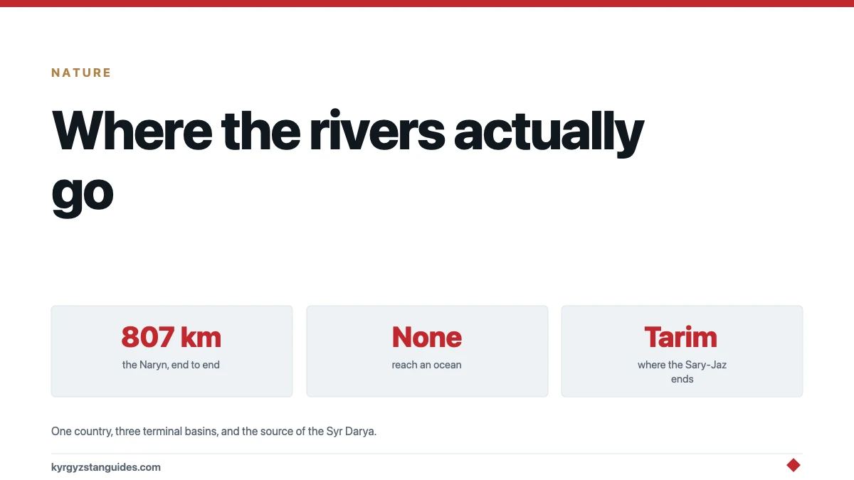
Not one river in Kyrgyzstan reaches an ocean. Every single one ends in a closed drainage system — a lake with no outlet, a desert that swallows it, or an inland basin in China.
That is the fact to hold on to, because it explains almost everything else about water here, including why the country's rivers are a regional political problem rather than a national scenic one.
The scale
Kyrgyzstan has over 3,500 watercourses, of which 30 are classed as large rivers. Count every stream and the water ministry's figure rises past 40,000.
Average annual river runoff is given variously as 44.5 km³, 47.2 km³ including return water, or 51.9 km³ depending on which body is counting and what they include. Take 44.5 to 51.9 km³ a year and say who says what, because the government's own sources do not agree.
The stored water tells a different story from the flowing water:
| Store | Volume | Share |
|---|---|---|
| Lakes | 1,745 km³ | 71% |
| Glaciers | 650 km³ | 26.4% |
| Annual river runoff | ~47 km³ | about 2% |
| Groundwater, mineral and thermal | 13 km³ | 0.5% |
Total 2,458 km³. The rivers are the small, moving fraction of a very large stationary asset, and the principal source of water in those rivers is meltwater from the glaciers. Our guide to Kyrgyzstan's glaciers covers what is happening to the 26 per cent.
The major rivers
Lengths below are within Kyrgyzstan, from the water ministry's own table.
| River | Length in Kyrgyzstan | Basin area | Ends up |
|---|---|---|---|
| Naryn | 616 km | 50,100 km² | Syr Darya, Aral basin |
| Talas | 294 km | 10,800 km² | Dies in the Moyunkum sands |
| Chu | 221 km | 22,800 km² | Dies in the Kazakh deserts |
| Kara-Darya | 189 km | 16,200 km² | Syr Darya, Aral basin |
| Sary-Jaz | 165 km | 12,100 km² | Tarim basin, China |
| Chatkal | 155 km | 6,900 km² | Chirchik → Syr Darya |
| Kyzyl-Suu | 128 km | 7,800 km² | See the warning below |
| Kökömeren | 108 km | 8,300 km² | Into the Naryn |
Three different destinations
To the Aral basin. The Naryn and the Kara-Darya meet in the Fergana Valley, on Uzbek territory, and the river that comes out of that confluence is the Syr Darya. Kyrgyzstan is where the Syr Darya physically begins. The Chatkal feeds the same system through the Chirchik.
To China. The Sary-Jaz crosses into Xinjiang and becomes the Aksu, the main feeder of the Tarim — a river that ends in the Taklamakan desert and reaches nothing.
To nowhere in particular. The Chu leaves the Issyk-Kul basin and dissipates in the Kazakh steppe. The Talas dies in the Moyunkum sands. And Issyk-Kul itself takes around 118 inflowing rivers and has no outlet at all, which is why it is saline. Son-Kul and Chatyr-Kul are closed basins too.
The Kyzyl-Suu warning
There are two rivers called Kyzyl-Suu, and they flow in opposite directions.
The Western Kyzyl-Suu drains southwest into the Vakhsh and Surkhob system in Tajikistan, and from there into the Amu Darya. The Eastern Kyzyl-Suu drains east into the Kokshaal-Darya and the Tarim, in China.
The water ministry's table gives a 128-kilometre Kyzyl-Suu without saying which. We are not going to guess, and neither should anything you read. If a source names a Kyzyl-Suu without specifying east or west, treat the claim as incomplete.
The Naryn in detail
It is the country's river in every sense that matters.
807 kilometres end to end, 616 of them in Kyrgyzstan and the rest in Uzbekistan's Namangan region. Basin area 59,900 km². It forms where the Chong-Naryn and Kichi-Naryn meet, both rising in the glaciers of the Central Tien Shan, and it runs through Issyk-Kul, Naryn and Jalal-Abad oblasts before crossing the border.
Hydrology, from secondary compilations rather than a Kyrgyz gauging authority, so treat as indicative: mean discharge at the mouth about 480 m³/s, maximum 2,820 m³/s, suspended sediment load 760 kg/s, peak flow in June and July.
That June–July peak is the glacier signature. The Naryn runs highest when the mountains are melting, not when it rains.
Which is why it is political
The Toktogul reservoir on the Naryn holds 19.5 km³ — the regulating reservoir for the entire Syr Darya. Whoever controls its release schedule controls whether Uzbek and Kazakh irrigation water arrives in summer, or whether it is run through turbines in winter to make Kyrgyz electricity.
The cascade below it runs Toktogul, Kurpsai, Tash-Kumyr, Shamaldy-Sai and Uch-Kurgan, with Kambarata-2 and the Upper Naryn cascade in construction. Recent work raised Toktogul's unit capacity from 300 to 360 MW and At-Bashi from 40 to 45.7 MW. Bala-Saruu, 25 MW, was near completion; Kulanak on the Naryn, 100 MW, was planned for commissioning by the end of 2025. Kambarata-1 is in preparatory construction.
For what all that means diplomatically, see Toktogul and water politics.
On the Chu and the Talas, Kyrgyzstan and Kazakhstan signed a shared-water agreement in 2000, which remains the model everyone points to for how this can be done without a quarrel.
What actually gets used
In 2023 the withdrawal limit was 8,364.2 million m³ and actual withdrawal was 8,081.6 million — 97 per cent of the ceiling. Irrigation delivery ran at 93 per cent of plan.
So the country uses roughly 8 km³ of the 44 to 52 km³ that flows through it. Most of the water leaves.
The National Water Strategy for 2023–2040 has fixed river basin boundaries hydrographically and produced management plans for five basins.
What the water ministry does not publish
Worth knowing before you go looking for more detail, because we went looking and did not find it.
The ministry's river table gives lengths and basin areas only. There is no discharge column. Outside the Naryn, we could not find a mean flow figure for a single major Kyrgyz river from a Kyrgyz authority — not the Chu, not the Talas, not the Kara-Darya, not the Chatkal, not the Sary-Jaz. The Naryn figures above come from a Russian hydrological compilation, not from a Kyrgyz gauging service.
Named headwaters are the same story. The Naryn's are documented; for the rest, the sources give a basin and a direction and stop.
That gap is not an accident of our searching. Kyrgyzstan is a country whose diplomatic weight rests almost entirely on being upstream, and whose public hydrological record is thin enough that an outsider cannot independently check how much water leaves it.
For a visitor
The rivers you will actually meet are the ones the roads follow. The Chu on the way out of Bishkek. The Chychkan in its gorge on the descent from Ala-Bel. The Naryn, wide and grey-green, for most of the drive through Naryn oblast. The Kökömeren, which is the one people raft — see rafting in Kyrgyzstan.
Two practical notes. Glacier-fed rivers run highest and dirtiest in June and July, which is exactly when trekking season peaks; a crossing that is ankle-deep in September can be impassable in July, and the meltwater peak is in the afternoon, not the morning. Cross early.
And the colour is not pollution. Grey-brown water here is rock flour, ground off the bedrock by ice and carried down. The Naryn moves 760 kilograms of it a second.
FAQ
What is the longest river in Kyrgyzstan?
The Naryn, at 807 kilometres end to end, of which 616 are inside Kyrgyzstan. Its basin covers 59,900 km². It is formed by the confluence of the Chong-Naryn and Kichi-Naryn, both fed by glaciers in the Central Tien Shan.
Do Kyrgyzstan's rivers reach the sea?
No. Every river in the country ends in a closed drainage system: the Naryn and Kara-Darya form the Syr Darya, which reaches the shrunken Aral; the Sary-Jaz becomes the Aksu and ends in the Tarim basin in China; the Chu and Talas dissipate in the deserts of Kazakhstan; and Issyk-Kul has no outlet at all.
Where does the Syr Darya start?
In Kyrgyzstan, effectively. The Naryn and the Kara-Darya both rise here and meet in the Fergana Valley on Uzbek territory, and the river formed at that confluence is the Syr Darya.
How much water does Kyrgyzstan have?
Annual river runoff is given as 44.5 to 51.9 km³ depending on the source and what is counted. Stored water totals 2,458 km³, of which lakes hold 1,745 km³ and glaciers 650 km³ — so the rivers are about 2 per cent of the total and glaciers are more than a quarter.
Which Kyrgyz rivers flow into China?
The Sary-Jaz, which crosses into Xinjiang and becomes the Aksu, the main feeder of the Tarim. The Eastern Kyzyl-Suu also drains east into the Kokshaal-Darya and the Tarim. Neither reaches any sea; the Tarim ends in the Taklamakan.
When do Kyrgyz rivers run highest?
June and July, because they are glacier-fed rather than rain-fed. The Naryn peaks then, and river crossings on treks are hardest in exactly the months when trekking season peaks. Meltwater flow rises through the day, so cross early in the morning.