For thirty years, one of Central Asia's most dangerous unresolved problems ran through the south-west of Kyrgyzstan. In September 2022 it produced deadly clashes between two states' armed forces. The border was closed. Batken region effectively came off the map for travellers.
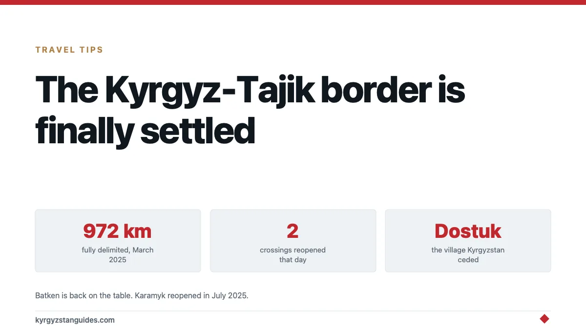
On 13 March 2025, Presidents Japarov and Rahmon signed a treaty in Bishkek delimiting the full 972 kilometres of the Kyrgyz–Tajik border and resolving every outstanding territorial claim.
The same day, two crossings reopened. This is the most consequential change to travel in southern Kyrgyzstan in a decade, and there's almost nothing written about it for visitors.
Why the border was a problem at all
Soviet internal boundaries in the Fergana valley were drawn around villages, canals and cotton land rather than around clean lines, and they were adjusted repeatedly through the 1920s to 1950s without a final authoritative map.
In 1991 those administrative lines became international borders, and the two states inherited different maps, each with legal-looking documentation supporting its own version.
Layer on top of that:
Exclaves. Vorukh — Tajik territory entirely surrounded by Kyrgyzstan, home to tens of thousands of people. Has to be reached across Kyrgyz land.
Water. Canals, intakes and reservoirs built as a single system now cross an international line. The 2021 conflict began at the Golovnoy water distribution facility.
Roads. Villages on both sides depended on roads that crossed the other country.
None of this was about ideology. It was about which village gets water in July, which is a much harder thing to negotiate.
What the treaty actually did
Delimitation had been creeping forward for years — 519 km agreed in 2011, a further 486 km over the three years before the treaty — and the remaining sections were exactly the hard ones.
The 2025 agreement closed them. The politically striking element: Kyrgyzstan ceded the village of Dostuk to Tajikistan, creating a connection between the Vorukh exclave and the Tajik mainland.
Dostuk means "friendship" in Kyrgyz. Giving up territory is not a thing governments in this region do casually, and doing it to de-exclave a neighbour's enclave is a substantial move. Both sides made trades; territory was exchanged rather than surrendered.
The Diplomat covered the finalisation and analysts at CACI have written on how durable it is likely to be, with the general verdict being historic but fragile.
Human Rights Watch has raised the position of the affected residents — people whose homes, land and access changed by treaty, and who were not parties to it. That part is unfinished, and it is the honest caveat on an otherwise good news story.
What reopened
| Crossing | Status |
|---|---|
| Kyzyl-Bel | Reopened 13 March 2025, closed since 2021 |
| Kairagach | Reopened 13 March 2025, closed since 2021 |
| Karamyk (Tojvaron) | Opened 8 July 2025 |
Direct air links and bus services between the two countries resumed alongside the crossings.
Karamyk is the significant one for travellers. It is the western route between Kyrgyzstan and Tajikistan, an alternative to the high Kyzyl-Art crossing on the Pamir Highway, and it had been shut for years. Our border crossings guide covers the practicalities of the network as a whole.
What this means for a trip
Batken is back on the table. The most overlooked region in the country, apricots, mountains, genuinely few visitors, spent years as a place foreign ministries told you not to go. That advisory picture has changed, though you should still check your own government's current guidance rather than taking a blog's word for it, this one included.
A second Tajikistan route exists again. Kyzyl-Art is spectacular and is a 4,280 m pass on a bad road that closes in winter. Karamyk is lower, easier and open more of the year. Having both changes what's plannable.
Conditions can still change. A treaty is signed. Demarcation. Physically marking the line on the ground — is the slower part, and local disputes over water and access have not stopped existing because a document exists. Check crossing status before committing to a route.
Be careful how you talk about it. In border villages, people lost relatives in 2021 and 2022 and some lost their homes to the settlement. It's not a geopolitics conversation there.
Photography near the line is a bad idea. As it always was, and more so in newly demarcated areas with fresh infrastructure.
The wider enclave problem
Kyrgyzstan's borders are strange in ways that only become obvious on a map, and Vorukh isn't the only case.
The Fergana valley is the densest and most agriculturally valuable land in Central Asia, and three countries meet in it. When Soviet planners drew republic boundaries there they were allocating irrigated land and cotton quotas, not designing nation-states, so they produced a patchwork: pockets of one republic inside another, roads that cross a line twice in ten kilometres, canals administered by one republic and feeding another.
Uzbekistan has exclaves inside Kyrgyzstan too — Sokh being the largest, with a population in the tens of thousands, and Shakhimardan being the other well-known one. The Kyrgyz–Uzbek border has had its own long delimitation process, which reached its own settlement in recent years.
So the Tajik treaty isn't an isolated event. It's the last and hardest piece of a broader untangling that has been running since 1991, and Kyrgyzstan happens to sit at the centre of it because it is the country the other two have pockets inside.
That is a useful thing to understand before you look at Osh and the south on a map and wonder why the roads do what they do.
Why it matters beyond the practical
Because it's the counter-example to how Central Asia is usually described.
The standard framing is authoritarian states with frozen conflicts and no capacity to resolve anything. What happened here's two governments that had recently shot at each other negotiating a comprehensive settlement, exchanging territory, and reopening crossings — without outside mediation being the decisive factor.
Whether it holds is the open question, and the regional reading is cautiously positive. What is not in doubt is that the thing most likely to start a war in this region three years ago has been addressed rather than deferred.
For a traveller, the effect is simple: a region that was closed is open, and the road south connects again.
FAQ
Is the Kyrgyzstan–Tajikistan border open?
Yes. The Kyzyl-Bel and Kairagach crossings reopened on 13 March 2025 after being closed since 2021, and Karamyk followed on 8 July 2025. Check current status before travelling, as conditions can change.
What did the March 2025 border treaty do?
It delimited the full 972 km Kyrgyz–Tajik border and resolved all remaining territorial claims, after 519 km had been agreed in 2011 and a further 486 km in the preceding three years.
What happened to the Vorukh exclave?
Vorukh remains Tajik. Kyrgyzstan ceded the village of Dostuk, creating a connection between the exclave and Tajikistan's main territory.
Why did Kyrgyzstan and Tajikistan fight over the border?
Soviet-era administrative lines through the Fergana valley were never finally agreed, and the two states inherited conflicting maps. Disputes centred on water infrastructure, roads and access to the Vorukh exclave, with armed clashes in 2021 and 2022.
Is it safe to travel in Batken region now?
The situation has changed substantially since the treaty, but you should consult your own government's current travel advice rather than relying on general reporting.
Can I cross from Kyrgyzstan to Tajikistan by road?
Yes, via Karamyk in the west or Kyzyl-Art on the Pamir Highway. Karamyk is lower and open for more of the year; Kyzyl-Art crosses a 4,280 m pass.
The oblast capital, the 2022 shelling and the border treaty that finally settled the line in March 2025 are covered in our Batken guide.