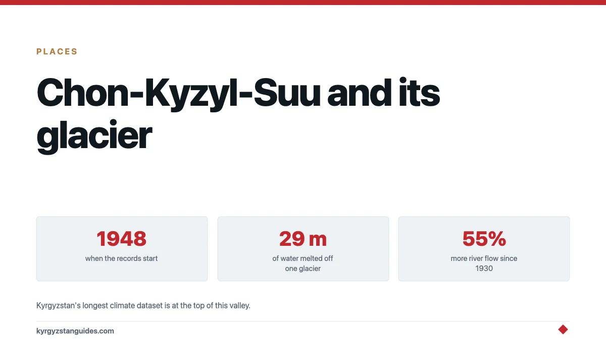
At the head of this valley there is a research station that has been taking meteorological observations continuously since 1948.
That is not a detail most travel writing about Issyk-Kul's south shore bothers with, and it should be, because it makes Chon-Kyzyl-Suu the place in Kyrgyzstan where you can see what has actually happened to the mountains rather than being told about it.
The valley
Чон-Кызыл-Суу means "big red water" — the river turns from turquoise to red in its lower reaches, from the colour of the soil.
The village at the mouth is Kyzyl-Suu, renamed from the Russian Pokrovka in 1992, in Jeti-Oguz district. The valley floor sits at about 2,000 metres and runs south into the northern slope of the Terskey Ala-Too. It is roughly 60 kilometres from Karakol and about 25 kilometres up the river from the lakeshore to the head of the road.
Dense forest starts around 2,000 metres — mushrooms, berries, barberry, rosehip, sea buckthorn, honeysuckle, wild strawberry, rowan. Edelweiss higher up.
The station
The Tien-Shan High-Altitude Physical-Geographical Station was founded in 1948 by the Institute of Geography of the USSR Academy of Sciences, on the northern slope of the Terskey Ala-Too in this valley. Since 1997 it has been the Tien-Shan High-Altitude Scientific Centre of the Institute of Water Problems and Hydropower at the Kyrgyz Academy of Sciences.
Its observation network spans 1,608 to 4,000 metres, with stations at named altitudes:
| Station | Altitude |
|---|---|
| Kara-Bulun | 1,609 m |
| Kyzyl-Suu settlement | 1,780 m |
| Forest checkpoint | 2,000 m |
| Kara-Batkak | 3,420 m |
It runs three laboratories — glaciology, coastal processes and biogeography — alongside hydrological and palaeoglaciological work.
Kara-Batkak is a reference glacier in the long-term global monitoring series. That matters: it means the numbers coming out of this valley are part of the international record rather than a local curiosity.
What seventy-eight years of measuring found
Two figures, from the institute's own published account:
Over sixty-odd years, a cumulative 29 metres of water equivalent melted off the Kara-Batkak reference glacier into the river.
Mean river discharge rose 55 per cent between 1930 and 2014.
Read those together and you have the mechanism of the whole Kyrgyz water story in one valley: the rivers are running fuller because the ice is leaving. Our guides to Kyrgyzstan's glaciers and its rivers cover where that goes next.
We have not checked those two figures against a peer-reviewed source; they come from the institute that produced them.
Why a valley with a research station is worth a traveller's time
A digression, but a short one.
Most of what a visitor hears about climate change in Kyrgyzstan arrives as an assertion — the glaciers are retreating, the rivers will change, the pastures are moving up. It is almost always true and almost never attached to a number you can check.
Here it is attached to numbers, and to a specific place you can walk to. There is a glacier with a name. There is a station with a founding date. There is a run of observations longer than most people reading this have been alive, taken in the same valley, by the same institution, through the collapse of the state that started it.
That continuity is the rare thing. Soviet scientific infrastructure across Central Asia mostly stopped in the 1990s; this did not. A station that has kept a daily record from 1948 to now, across two countries and an economic collapse, is itself a kind of monument.
You will not be given a tour. The centre is a working institution, not a visitor attraction, and nothing about it is set up for tourism. But knowing it is there changes what the valley looks like on the way up.
What else is up there
Hot springs. On the eastern slopes, on the Jyluu-Suu tributary, there are hot mineral sulphide springs at about 43°C. Whether any built bathing facility exists there, we could not establish.
A refuge at 2,500 metres offering beds and Kyrgyz sleeping platforms, a sauna, camping, horse riding, guided trekking and wildlife watching. Reservations by email; prices on request. Wildlife cited includes snow leopard, ibex and marmot.
Note a likely duplication in the sources: an "old physical-geological station at 2,600 metres" also appears, and it is probably the same building as the 2,500-metre refuge. We could not confirm it.
Savator lake and a waterfall in the Ashuu-Toer gorge.
Trekking
This valley is the western trailhead for the Archa-Tor pass crossing to Jeti-Oguz — three days, 33 kilometres, a pass at 3,800 to 3,980 metres depending on source, rated medium, June to October. It is the single best alternative to the overcrowded Ala-Kul route, and we set out the case in alternatives to Ala-Kul.
Other ways in and out: up the river from Pokrovka, 25 kilometres; over the Savatar or Karatakkya passes from adjacent valleys. A longer traverse of the Terskey Ala-Too from here to Altyn-Arashan is sold as a twelve-day route.
Operators typically start their itineraries with a 60-kilometre transfer up the gorge as far as the Jyluu-Suu springs.
Season June to September, when the passes are clear. The valley road is summer-only.
Practical shape of a visit
Two ways to use the valley, and they are quite different trips.
As a day or overnight from the lake. Base at Kyzyl-Suu village or at Tamga further west, drive or hire transport up the gorge as far as the Jyluu-Suu springs, walk, and come back down. That gets you forest, the river and the hot springs without committing to a pass.
As the start of the Archa-Tor crossing. Transfer up the valley, camp, climb to the pass and drop into Jeti-Oguz on the far side. Three days, no established campsites, and you need to be carrying everything.
The second is the reason most trekkers come. The first is why the valley deserves a mention in its own right rather than only as a trailhead.
A note on timing that applies to both: the road up is summer-only and the passes are June to September. Outside that, the valley is a lakeside village with a closed road behind it.
Getting there
By road from Karakol, about 60 kilometres west along the south shore to Kyzyl-Suu village, then up the valley. Excursions into the gorge also run from Tamga, further west.
See the Issyk-Kul south shore for the wider route, and Jeti-Oguz for the valley the Archa-Tor crossing drops into.
The honest gaps
No prices are published for anything here — not the refuge, not the sauna, not horse hire, not the springs. The destination organisation says to email.
We could not confirm whether the refuge is open in 2026 or who runs it, whether the valley sits inside a protected area with an entry fee, or what the road requires in the way of a vehicle. If you are planning around it, write first.
And on one point of the original premise: we looked for a botanical research station here and did not find one. What exists is a physical-geographical and glaciological station with a biogeography laboratory, which is a different thing.
FAQ
Where is Chon-Kyzyl-Suu valley?
On the south shore of Issyk-Kul, running south from Kyzyl-Suu village — formerly Pokrovka — into the northern slope of the Terskey Ala-Too. It is about 60 kilometres from Karakol, with roughly 25 kilometres of road up the valley from the lakeshore.
What is the research station at Chon-Kyzyl-Suu?
The Tien-Shan High-Altitude Scientific Centre, founded in 1948 as a station of the USSR Academy of Sciences and since 1997 part of the Kyrgyz Academy's Institute of Water Problems and Hydropower. It has run continuous meteorological observations since 1948 across a network from 1,608 to 4,000 metres.
Why does the Kara-Batkak glacier matter?
It is a reference glacier in the long-term global monitoring series, so its record feeds the international dataset. Over roughly sixty years a cumulative 29 metres of water equivalent melted off it, and mean river discharge in the valley rose 55 per cent between 1930 and 2014.
Are there hot springs at Chon-Kyzyl-Suu?
Yes, on the Jyluu-Suu tributary on the eastern slopes, hot mineral sulphide springs at around 43°C. Whether there is any built bathing facility there is not documented in sources we could reach.
What trek starts from Chon-Kyzyl-Suu?
The Archa-Tor pass crossing to Jeti-Oguz — three days, 33 kilometres, with the pass at somewhere between 3,800 and 3,980 metres depending on the source. It is rated medium, runs June to October, and has no established campsites.
Can I stay in the valley?
There is a refuge at around 2,500 metres offering beds, sleeping platforms, a sauna and camping, with horse riding and guided trekking available. Reservations are by email and prices are on request; we could not confirm whether it is open in 2026.
The same geothermal system surfaces lower down at Ak-Suu, a sanatorium village a 25-som marshrutka from Karakol.