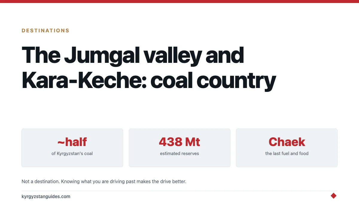
Most of the coal that keeps Kyrgyzstan warm through winter comes out of one valley in Naryn province, and it isn't on anyone's itinerary. The Jumgal valley runs between the Moldo-Too and Kabak-Too ranges, its main town is Chaek, and 25 to 30 kilometres south of that sits Kara-Keche, five open-cast pits producing roughly half the country's coal.
If you drive from Kochkor towards Suusamyr you go through this. Knowing what you're looking at makes the drive considerably more interesting.
What's actually there
Kara-Keche is a surface lignite operation run by the state coal company, Kyrgyz Komur, and it is the largest coal mine in the country. Estimated reserves run to 438 million tonnes. Production reached about 1.3 million tonnes in 2024, and a coal enrichment plant has been under construction at the field.
Lignite is brown coal. Low grade, high moisture, and the reason Bishkek's winter air is what it's. Anyone who has spent January in the capital has breathed this valley.
The pits are working industrial sites, not attractions. You don't visit Kara-Keche; you pass the trucks coming out of it, and you notice the road surface deteriorating as you do.
The valley itself
Strip out the mine and Jumgal is a broad high valley of the kind that makes up most of Naryn province, pasture, low hills, herds, small settlements strung along a river.
Chaek is the administrative centre and the place with a shop, a bank and fuel. It is not a tourist town and makes no pretence of being one.
The pass over from Kochkor and the run south towards Suusamyr give you the landscape that Naryn does better than anywhere: wide, empty, high, with the ranges standing back from the road rather than closing in on it. Our Kochkor guide covers the junction town at the eastern end, and Suusamyr the basin at the other.
In summer the jailoos above the valley fill with herders, as they do throughout this province. Nobody has built a tourism operation around them here, which is the difference between Jumgal and Song-Kul, an hour or two away.
The coal wars, briefly
Kara-Keche has a history that explains why coal here's political rather than merely industrial.
In the turbulence following Kyrgyzstan's 2005 revolution the mine was seized and held by a self-appointed local figure, and control of the field was contested for years afterwards. Eurasianet reported on the resulting disruption to what is, in energy terms, critical national infrastructure.
Why it matters to anyone reading a travel page: it's a compact illustration of how much depends on this valley. A country that can heat itself only if one coal field keeps producing has a fragility that the scenery does not advertise.
Things have been considerably more settled since, and the practical situation for a traveller driving through is simply a working mine with trucks on the road.
Why the roads are like that
Coal trucks, mostly.
Heavy vehicles running a mining road year-round do to a surface exactly what you'd expect, and the maintenance doesn't keep up. Add the terrain: in September 2020 a landslide of around 0.9 million cubic metres came down at the 37th kilometre of the Dyikan–Karakichi road, blocking the river, taking out power lines and closing the road entirely.
That's the sort of thing this valley produces. Steep, loose, seismically active ground, as our piece on Kyrgyzstan's earthquakes explains, with a road cut through it and loaded trucks on top.
Practical version: don't assume a road on a map here is open, and ask locally in spring and after heavy rain.
Coal, winter and the honest picture
Kyrgyzstan burns coal because the alternative is cold.
Hydropower supplies most of the country's electricity, but hydro output falls in winter exactly when demand rises, and the reservoirs are drawn down. Coal fills that gap, in power stations and in tens of thousands of household stoves. Which is why a lignite basin in Naryn province matters nationally in a way that a mine of this size wouldn't in a larger economy.
It is also why Bishkek's winter air is among the worst of any capital in the region, and why the glacier story and the coal story are the same story: our glaciers piece covers what happens to the hydro side as the ice goes.
None of this makes for cheerful reading. It's, though, the actual economy of the country you're travelling in, and a page that only describes yurts and lakes isn't describing Kyrgyzstan.
Chaek, if you stop
Small, administrative, and useful rather than charming.
There's fuel, a shop or two, a bank, and somewhere to eat the standard canteen lineup — laghman, manty, plov. That is genuinely worth knowing, because between Kochkor and the Suusamyr basin there isn't much else, and running low on petrol in this valley is an avoidable mistake.
There's no tourist accommodation to speak of. Homestays exist in the wider district through the community network, but this isn't a place with a booking page, and arriving after dark expecting a bed is optimistic. Our CBT guide explains how the network works where it exists.
Carry som. As with everywhere outside the main towns, cards are not a factor here — our paying in Kyrgyzstan guide covers where the line falls.
What the valley looks like in winter
Worth saying, because most descriptions of Naryn assume July.
Jumgal at 2,000-odd metres in January is severe. Temperatures well below freezing for months, the passes at either end closing without much notice, and villages running on the coal that comes out of the ground a few kilometres away. The smoke sits in the valley on still days.
For a traveller that means the window here is summer and early autumn, and the honest reason to know about the winter is that it explains everything else — why the mine matters, why the houses look the way they do, why the herds go up in May and come down in September.
Should you go?
Not for the mine.
Go through Jumgal if your route takes you between Kochkor and Suusamyr, which is a genuinely good drive and a quieter alternative to the standard northern circuit. Stop in Chaek for fuel and lunch. Look at the valley, which is handsome in the understated way Naryn is handsome.
Don't plan a trip around it, don't try to visit the pits, and don't photograph industrial installations or the people working them without asking. That is a bad idea in any country and a worse one here.
The reason to know about Kara-Keche isn't that it's a destination. It's that understanding where a country's heat comes from tells you more about it than another lake does.
FAQ
Where is the Jumgal valley?
In Naryn province, between the Moldo-Too and Kabak-Too ranges, with Chaek as its main town. It lies on the route between Kochkor and the Suusamyr valley.
What is Kara-Keche?
Kyrgyzstan's largest coal mine — five open-cast lignite pits about 25–30km south of Chaek, run by the state company Kyrgyz Komur. Estimated reserves are around 438 million tonnes, with 2024 production of roughly 1.3 million tonnes.
Can tourists visit the Kara-Keche mine?
No, and there's nothing set up for it. These are working industrial sites. You'll pass coal trucks on the road, which is as close as a visitor gets or should want to get.
Why does Kyrgyzstan burn so much coal?
Because hydropower output drops in winter as reservoirs are drawn down, exactly when heating demand peaks. Coal covers that gap in power stations and household stoves, which is why one lignite basin matters nationally.
Is the road through Jumgal in good condition?
Variable and often poor. Heavy coal traffic degrades the surface, and the terrain is landslide-prone — a 0.9 million cubic metre slide closed the Dyikan–Karakichi road in September 2020. Ask locally in spring or after heavy rain.
Is the Jumgal valley worth driving through?
As part of a Kochkor to Suusamyr route, yes. It's a wide, quiet, high valley of the sort Naryn does well, with far fewer vehicles than the Issyk-Kul circuit. It isn't a destination in its own right.