There is no reliable mountain forecast for most of this country.
Weather apps will give you a figure for the nearest town, which may be 2,000 metres lower and on the other side of a range. For the valley you are actually walking in, there's nothing: and the difference between the two can be the difference between a warm afternoon and a snowstorm.
So you read it yourself. Here is what to read.
Why forecasts fail here
The terrain is the weather. A range that rises 3,000 metres from a valley floor generates its own local systems. Air forced up a slope cools and dumps precipitation; air descending the far side warms and dries. Two valleys thirty kilometres apart can have completely different days.
Station coverage is thin. Kyrgyzhydromet operates the national network, and it isn't dense in the mountains. Model forecasts for high valleys are interpolation, not observation.
Resolution is too coarse. Global weather models work on grid squares far larger than a Kyrgyz valley. The model sees an averaged lump of terrain, not the ridge you are standing under.
Continental extremes. Far from any ocean, with nothing to moderate temperature. A 25°C daily swing at altitude is unremarkable.
The daily pattern
Once you know it, most days here are predictable in shape.
Clear and cold at dawn. Radiative cooling overnight under a dry sky. Frost at 3,000 m in July is normal.
Building cloud from late morning. The sun heats the slopes, air rises, and cumulus forms over the ridges. This is convection and it is almost daily in summer.
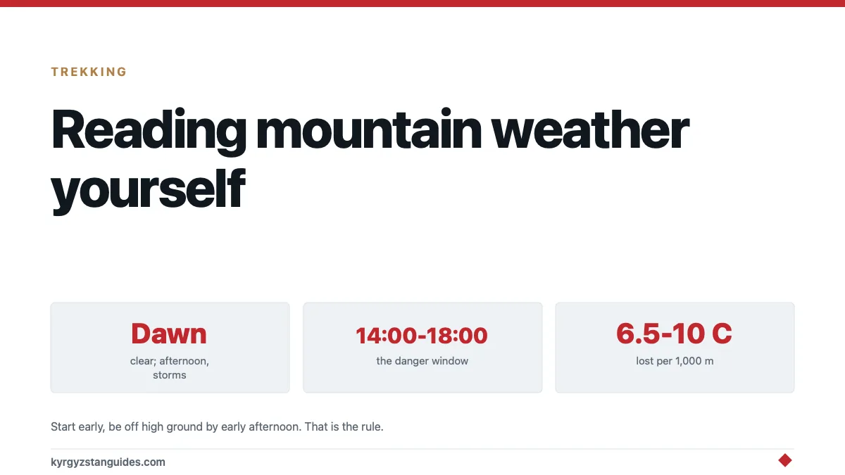
Afternoon showers or storms, roughly 14:00–18:00. Often localised, often brief, occasionally violent with hail and lightning.
Clearing in the evening. Convection stops when the heating does, and a cloudy afternoon frequently becomes a clear night, which is the good news for stargazing.
The operational consequence is simple and it is the single most useful rule in this guide: start early, be off high ground by early afternoon.
Signs worth knowing
Lenticular cloud — smooth, lens-shaped, stationary over or downwind of a peak. Strong wind aloft. Often the first sign of an incoming front.
Cumulus growing vertically before noon. If towers are building at eleven o'clock rather than two, the atmosphere is unstable and the afternoon will be worse than usual.
Cap cloud sitting on a summit and thickening. Deteriorating.
High thin cirrus spreading from the west. A front twelve to twenty-four hours out.
A sudden drop in temperature with a wind shift. Front arriving now.
Very clear, very sharp visibility. Frequently precedes a change rather than confirming a settled spell.
Valley wind reversal. Up-valley during the day, down-valley at night, driven by heating. A wind blowing the wrong way for the time of day means something else is in charge.
The specific hazards
Lightning above the tree line. The genuine killer in afternoon storms. A ridge, a pass or an open jailoo at 3,000 m is the worst place to be. Descend, avoid summits and isolated features, and spread a group out.
Hail. Sudden, heavy and painful, and it makes slabby ground instantly treacherous.
Snow in any month. Above 3,000 m, snow in July is unremarkable. Passes can close for a day in midsummer.
Wind chill. The number on the thermometer isn't the problem; the wind on a pass is.
Rivers rising through the afternoon. Glacier and snow melt peaks in late afternoon, so a crossing that was knee-deep at nine o'clock may be impassable at five. Cross early. This kills trekkers here.
Rain triggering mudflows. Heavy rain upstream produces debris flows in gullies that are dry where you stand.
What to actually use
Mountain-specific forecast models. Sites that run high-resolution models and let you pick an altitude are far more useful here than a general weather app — Mountain-Forecast covers Kyrgyz peaks by elevation band.
Multiple models, and disagreement as information. If two models disagree, the forecast is genuinely uncertain rather than one being wrong.
Satellite imagery. Cloud movement over the region tells you more about the next six hours than a text forecast does. EUMETSAT and equivalent public imagery covers Central Asia and updates frequently enough to be useful.
Ask locally. Herders and guides read this ground better than any model. "Will it rain?" is a reasonable question to ask at breakfast and you'll get a considered answer.
A barometer. Most sports watches and phones have one. A falling trend over three hours means something is coming; the absolute number matters less than the direction.
Kyrgyzhydromet, the national meteorological service, publishes warnings and regional forecasts, in Russian and Kyrgyz, which is a barrier but not an insurmountable one with a translation app.
Altitude and temperature
A rule worth carrying, because it lets you convert a valley forecast into something useful.
Air cools with height at roughly 6.5°C per 1,000 metres in moist conditions, and closer to 10°C per 1,000 metres in the dry air that dominates here.
So a forecast of 28°C in Karakol at 1,700 m implies something in the region of 15°C at a 3,000 m camp before you account for wind. And nearer freezing overnight once the sun goes and radiative cooling takes over under a clear sky.
That last part is the one that catches people. Dry air and a cloudless night lose heat extremely fast. The daily range at 3,000 m in July routinely runs from 20°C in the afternoon to below zero before dawn, which is why our yurt stay guide is insistent about sleeping bags.
Add the wind. A moderate breeze at 5°C produces an effective temperature well below that, and passes are where the wind lives.
Season by season
June. Unsettled and wet, but flowers and fewer people. Expect afternoon storms and passes that may not be open.
July–August. The most reliable stretch. Hot in valleys, afternoon convection almost daily, high passes generally open. The jailoo season for a reason.
September. The best month for stable weather and clear air. Cold at night, shortening days, real risk of the first snow at altitude.
October onward. Winter conditions at height. Trekking becomes mountaineering.
Our best time to visit guide covers the seasons more broadly, and winter is a different country.
FAQ
Is there a reliable mountain weather forecast for Kyrgyzstan?
Not for most valleys. Weather station coverage in the mountains is thin and global models are too coarse for this terrain, so forecasts are interpolations rather than observations.
What is the typical daily weather pattern in the Kyrgyz mountains?
Clear and cold at dawn, cloud building from late morning, showers or storms in the afternoon between roughly 14:00 and 18:00, and clearing in the evening.
When should I start a mountain day in Kyrgyzstan?
Early. Aim to be off high ground and past river crossings by early afternoon, before convective storms build and before meltwater peaks.
Can it snow in summer in Kyrgyzstan?
Yes. Snow above 3,000 m is unremarkable in July and August, and high passes can close for a day even in midsummer.
Why do rivers rise in the afternoon?
Because they're fed by snow and glacier melt, which peaks with the day's heating. A crossing that is easy in the morning can be dangerous by late afternoon.
What is the most dangerous mountain weather hazard here?
Lightning in afternoon storms above the tree line, along with afternoon river crossings and rain-triggered debris flows in gullies.
The traditional year underneath all this starts at the equinox, not in January: see the Kyrgyz folk calendar.