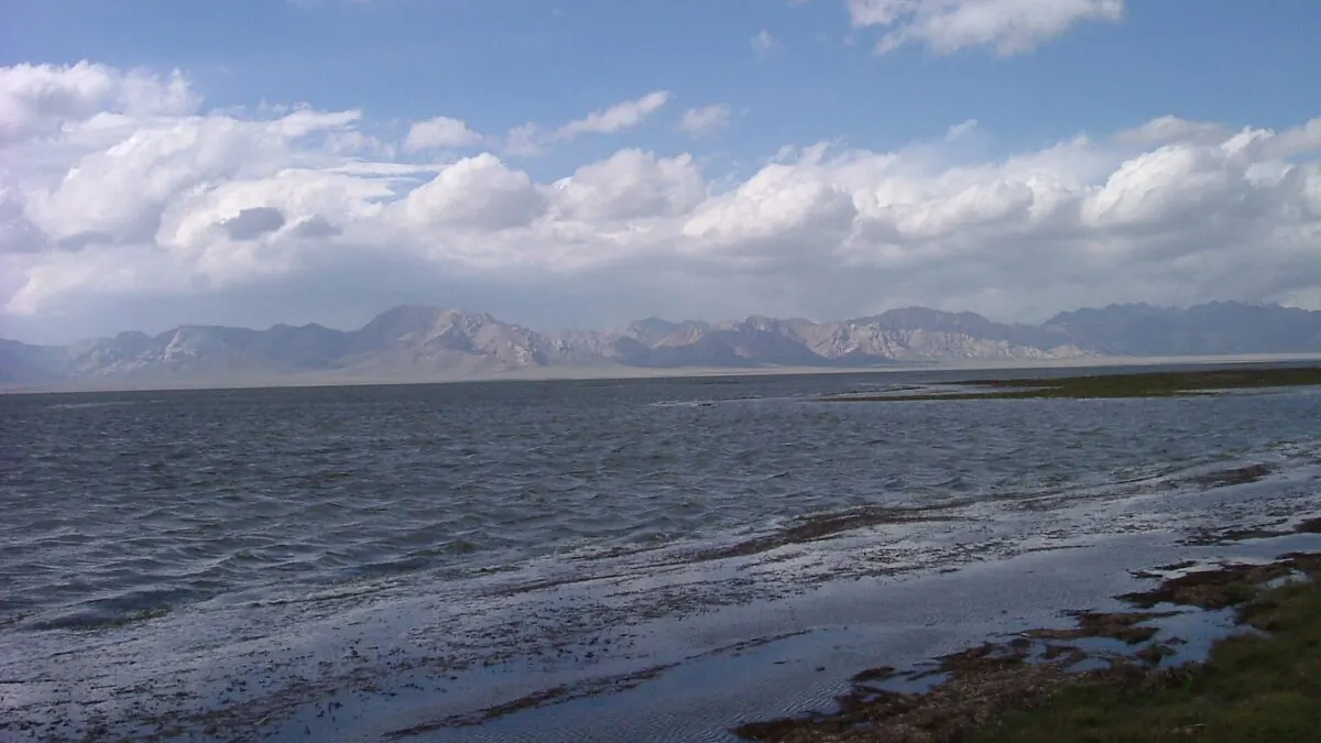
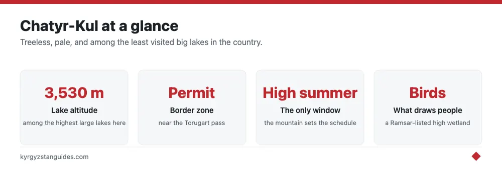
At 3,530 metres, Chatyr-Kul is one of the highest large lakes in Kyrgyzstan and among the least visited — a pale, treeless sheet of water pressed against the Torugart Pass and the Chinese frontier in the far south of Naryn region. Very few travelers reach it, and that isn't an accident of remoteness alone.
Chatyr-Kul sits inside a controlled border zone, so visiting legally requires a border-zone permit, issued by the State Registration Service rather than the border service — you cannot simply drive up and take a look. That single fact, more than the altitude or the rough road, is why the lake stays off almost everyone’s itinerary. Get the paperwork sorted and the reward is a genuinely wild high-mountain lake, a Ramsar-listed bird wetland, and some of the emptiest landscape in the country. Here is what it is and how to actually get there.
What Chatyr-Kul actually is
The name is usually translated as something like ‘celestial’ or ‘roof’ lake, and both fit a body of water sitting near the roof of the country. It is an endorheic lake — water flows in but nothing flows out, so it is slightly brackish and, being high and cold, almost fishless. That emptiness of fish is part of the point: without a fishery, the shoreline belongs to birds and the odd herder rather than to anglers or resorts.
By area it ranks among Kyrgyzstan’s largest lakes after Issyk-Kul and Song-Kul, though the shallow water level shifts with the seasons. It freezes solid in winter and lies in a broad, wind-scoured basin ringed by the Torugart and At-Bashy ranges. There is no town, no resort strip, no yurt tourism circuit — just the lake, the mountains, and the border posts beyond.
The setting is what stays with people who make it up here. The basin is vast and open, the light hard and clean at altitude, and the silence near-total apart from wind and birds. There are no trees to soften the horizon and no buildings to give it scale, so the eye reaches for the ranges and the far Chinese peaks. It is a stark rather than a pretty landscape — more Tibetan plateau than alpine postcard — and that austerity is precisely the draw for the travelers who seek it out.
A protected bird wetland
Chatyr-Kul is the heart of the Karatal-Japyryk reserve and a wetland of international importance under the Ramsar convention, which is a fancy way of saying it matters far more to ornithologists than to the average traveler. Despite the altitude and cold, it is a breeding and staging ground for high-mountain waterbirds — bar-headed geese, mountain waterfowl and migratory species that pass through on the great Central Asian flyways. If you time a visit for summer and bring binoculars, the birdlife is the real spectacle, not the shoreline, which is bleak and bare by design.
Because it is a reserve as well as a border zone, the expectation is low-impact visiting: no camping right on the sensitive shore, no disturbance of nesting birds, and a light footprint generally. This is a look-and-leave place, not a picnic lake.
Why it is off the beaten path
Three things keep the crowds away, and they compound. The permit is the first — the border-zone paperwork takes days and forward planning, which filters out spontaneous travelers entirely. The remoteness is the second: the lake sits at the far end of a long, high, rough road up the At-Bashy valley, hours beyond the last real town. And the third is that there is nothing to do in the resort sense — no boats, no swimming in near-freezing water, no facilities. What is left is scenery and solitude, which is exactly what the handful of people who make the effort come for.
Tash-Rabat and the Torugart
Chatyr-Kul rarely stands alone on an itinerary. The natural anchor is Tash-Rabat, the stone caravanserai in a side valley of At-Bashy, which most travelers reach first and use as a base or overnight before pushing higher to the lake. The whole area is threaded by the historic Silk Road line toward China.
This corner of the country carried real Silk Road traffic once. Caravans moving between the Tarim Basin and the Fergana Valley crossed these passes, and Tash-Rabat’s thick stone walls were built to shelter them — a reminder that the emptiness here is recent, not eternal. Standing at Chatyr-Kul, it's easy to picture the route as the working artery it was rather than the dead end it can feel like today.
The lake also sits just below the Torugart Pass, one of the two road crossings between Kyrgyzstan and China. Torugart is a restricted crossing — you cannot use it as a casual walk-up border, and it comes with its own permit and vehicle rules on both sides. Some travelers see Chatyr-Kul in passing while crossing to or from China; others visit purely from the Kyrgyz side and turn back. Our border crossings guide explains where Torugart fits among the country’s posts.
If you want the same flavor of remote, permit-controlled high lake without the China-border complications, Kel-Suu in the same broad region is the obvious companion or alternative — equally wild, also inside a border zone, and often combined with Chatyr-Kul on a longer southern loop.
How to visit
Do this through an operator, and start early. The border-zone permit needs your passport details submitted in advance and typically several working days — sometimes a week or two — to process, so it isn't something to arrange the night before. Naryn-based community tourism offices and Bishkek agencies both handle the paperwork and the transport as a package, usually bundling Tash-Rabat, Chatyr-Kul and sometimes a Torugart transfer.
You need a capable vehicle. The track up from Tash-Rabat over the At-Bashy ridge to the lake basin is high, rough and weather-exposed, well beyond an ordinary car. Most visits run as a day trip from a Tash-Rabat yurt camp or a longer loop out of Naryn town. For reaching Naryn and the At-Bashy valley in the first place, see our transport guide.
When to go
This is a short-season destination. The road is realistically open from about June to September, with July and August the safest window for the high pass and the most active for birdlife. Even in mid-summer, expect cold, wind and the chance of snow at this altitude — pack as if for autumn regardless of the calendar. Outside that window the basin freezes, the road becomes a gamble, and permits are moot because operators simply will not run the route. Come in high summer, treat the weather with respect, and keep your plans flexible: at 3,530 metres, the mountain decides the schedule, not you.
Before you fish anywhere here, read the fishing rules: a three-year moratorium on commercial catch in Issyk-Kul and Son-Kul runs to July 2029, and two Red Book species carry criminal liability.
For passage and moulting rather than resident species, see bird migration over Kyrgyzstan, where around 40 per cent of the Central Asian ruddy shelduck population moults on one lake.
The birds, and why there are so many
Chatyr-Kul became a Ramsar site on 8 November 2005, covering 16,100 hectares inside the Karatal-Japyryk reserve, with a two-kilometre buffer zone.
The reason it matters is a single physical fact: the lake is completely fishless. With nothing stripping out the invertebrates and plankton, the food base is undepleted and the birds have it to themselves. A 2004 expedition counted 52 species and an estimated 21,903 individuals, which clears the Ramsar threshold of 20,000 waterbirds.
The headline species is the ruddy shelduck. Between 5,000 and 10,000 are present, and around 40 per cent of the entire Central Asian population moults here — one count reached 17,800 birds, about 35.6 per cent of the population. The threshold for international significance is 500. Moulting birds are flightless for weeks while they replace their flight feathers, which is exactly why a fishless lake at 3,530 metres with almost no people is worth that much of a population.
There is also a breeding colony of bar-headed geese, the birds that cross the Himalaya, plus more than 500 individuals each of five dabbling duck species and over 1,000 each of four diving ducks.
When the birds are actually there
This is the one dated migration figure in the Kyrgyz official record. The site documentation states that movement begins in the second half of August and that September to October is the high point of migration.
If you want the moulting concentrations rather than passage, you want midsummer — by late August the moult is finishing.
In winter the lake freezes and is snow-covered. It is a summer and passage site, not a wintering one, which is the opposite of Issyk-Kul's role on the same flyway.
Fishing here is not a grey area
Chatyr-Kul sits inside a zapovednik. Under the Criminal Code, illegal taking of fish or wildlife inside a state reserve carries five to seven years' imprisonment, regardless of value. The lake is fishless in any case, but the surrounding reserve is not a place to improvise. See Kyrgyzstan's fishing rules.
FAQ
Do I need a permit to visit Chatyr-Kul?
Yes. The lake lies inside a controlled border zone next to the Chinese frontier, and a border-zone permit must be arranged in advance. It is issued by the State Registration Service rather than the border service, and it takes several working days, so it cannot be organised on the day.
How high is Chatyr-Kul?
3,530 metres, which makes it one of the highest large lakes in Kyrgyzstan. It covers 16,100 hectares and sits in the far south of Naryn region, pressed against the Torugart Pass.
Are there fish in Chatyr-Kul?
No. The lake is completely fishless, and that is precisely why it matters ecologically: with nothing stripping out the invertebrates and plankton, the food base is left to the birds. It is the stated basis of the lake's Ramsar listing.
When is the best time to visit Chatyr-Kul?
Midsummer for the moulting bird concentrations, or September to October for passage migration, which the official site documentation names as the high point. The lake freezes and is snow-covered in winter, and the road over the pass is a summer proposition.
What birds are at Chatyr-Kul?
A 2004 expedition counted 52 species and about 21,903 individuals. The headline species is the ruddy shelduck: 5,000 to 10,000 are present and around 40 per cent of the entire Central Asian population moults here. There is also a breeding colony of bar-headed geese.
Can I camp or fish at Chatyr-Kul?
The lake sits inside the Karatal-Japyryk state reserve, a zapovednik, where illegal taking of fish or wildlife carries five to seven years' imprisonment under the Criminal Code. It is fishless anyway. Treat the whole area as a reserve with restrictions rather than open country, and go with an operator who knows the rules.