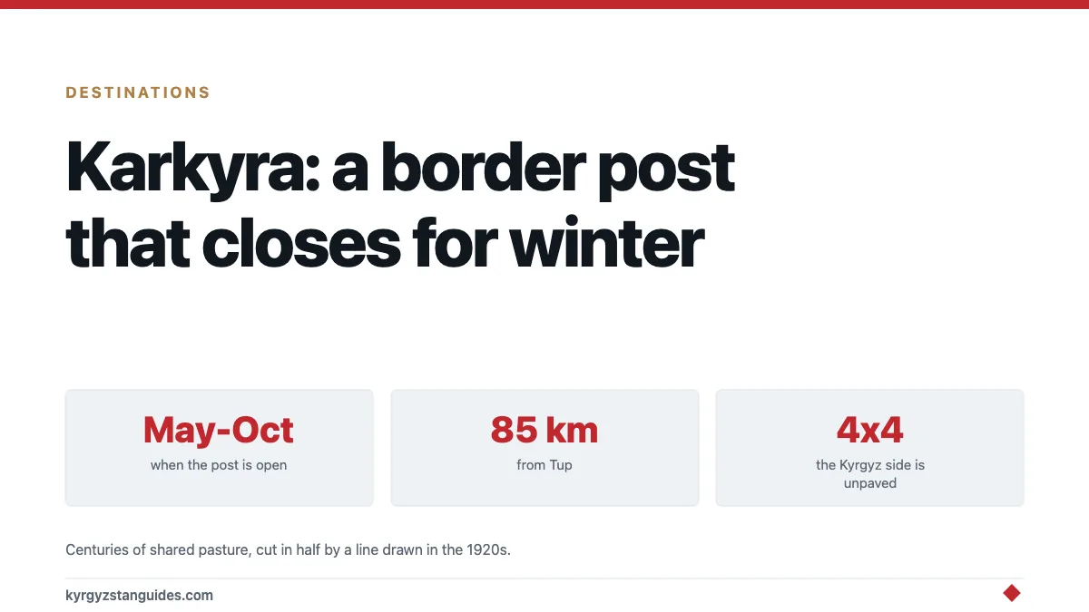
There is a crossing into Kazakhstan that only exists in summer. The Karkyra valley post sits high in the Tien Shan between Tup on the Kyrgyz side and Kegen on the Kazakh, opens around May, shuts around October, and spends the rest of the year under snow with nobody at it. It is the most scenic land border in Central Asia and the one most likely to be closed when you arrive.
The valley itself is worth the drive whether or not you cross. It has been summer pasture for Kyrgyz and Kazakh herders for centuries, and in July it looks like it.
What's actually up there
A wide, high, green valley with the Tien Shan standing around it: the kind of jailoo that Song-Kul is famous for, without Song-Kul's yurt-camp economy.
Herds come up here in summer from both sides of a border that did not exist for most of the valley's history, and the grazing patterns are older than the line on the map. You'll see livestock, felt tents, horses, and very little else. There is no village of any size, no tourist infrastructure, and no reason for anyone to be there who isn't herding or crossing.
Distances: roughly 85 kilometres from Tup on the Kyrgyz side, about 30 from Kegen in Kazakhstan. Our Karakol guide covers the town most travellers set out from.
Crossing, if it's open
The Kegen–Karkyra post is the natural link between the Kolsai lakes and Charyn canyon area of Kazakhstan and the Issyk-Kul basin. People coming from Saty in Kazakhstan towards Karakol use it constantly in season, and it saves a very long detour round the western end of the lake.
Things to know before you plan around it:
It's seasonal. Roughly May to October, and the dates move with the snow rather than with a published calendar. Early May and late October are gambles.
The hours are short. As of 22 September 2026 the Kyrgyz State Border Service put them at 09:00 to 20:00, a reduced schedule set unilaterally by the Kazakh side. It is a remote post with limited hours and limited staff, not a 24-hour highway crossing. Arrive in the middle of the day.
The road is unpaved on the Kyrgyz side and wants a 4x4 or at least a car with some clearance. A low saloon after rain is asking for trouble.
There is no public transport through it. You need your own vehicle, a hired driver, or an arranged transfer that meets you on the other side. Hitching happens but isn't a plan.
Confirm before you commit. Border arrangements in this region change with little notice. Caravanistan's border crossings page is the most reliable running record, and our own border crossings guide covers the alternatives.
The fallback if it's shut is the Korday crossing near Bishkek, which is open year-round and considerably duller, our Bishkek to Almaty guide covers that route.
A border drawn across a pasture
The thing that makes Karkyra interesting is that the line is younger than the use.
Kyrgyz and Kazakh herders have been bringing animals up to this valley for centuries, from both directions, in a pattern that treated the whole basin as one grazing system. The frontier arrived with Soviet republican boundaries and hardened into an international border in 1991, cutting a summer pasture in half.
You can see the result if you look: a modern crossing with barriers and a queue, sitting in the middle of country where the practical unit has always been the valley rather than the state. Herders on both sides are closely related, speak mutually intelligible languages, and are now citizens of different countries with different currencies.
Border Crossing Hub's summary of the post is a useful practical reference, and it also captures how small and improvised the whole thing still feels. This is a border in a field.
Which is a good thing to hold in mind generally when travelling in Central Asia, where a great many lines on the map were drawn in the 1920s and 30s by people a long way away, and where they cut across valleys, ethnic groups and grazing routes with some enthusiasm.
Going just for the valley
Entirely reasonable, and most people don't think of it.
From Karakol or Tup you can drive up into Karkyra, spend a day in the pasture, and come back without going near the border post. No permit is required for the valley itself — this is not a restricted border zone in the way Kel-Suu or Chatyr-Kul are, though you should keep your passport with you and stay away from the actual frontier.
What you get: high open grassland, herds, the Tien Shan, and almost nobody. What you don't get: facilities of any kind. Bring food, water, fuel and warm clothing, and expect no phone signal for much of it.
July and August are the months. The grass is at its best, the herders are up, and the valley is doing the thing it exists to do.
The Tup and Karkyra side of Issyk-Kul
This whole corner of the lake is underused by visitors, who mostly stop at Karakol and turn round.
Tup is a small town at the eastern end of the north shore, the junction for the Karkyra road, and an unremarkable but useful place with fuel and a shop.
The north shore east of Cholpon-Ata thins out quickly into farmland and quiet villages, which is a pleasant change from the resort strip. Our Issyk-Kul guide covers the lake as a whole and Cholpon-Ata the busy end of it.
Jyrgalan, south-east of Karakol, is the trekking village in the same general direction. See our Jyrgalan guide.
A loop taking in Karakol, Jyrgalan and Karkyra is a genuinely good week that almost no itinerary includes.
Timing and weather
Snow governs everything here, as it does throughout the Kyrgyz mountain calendar.
The valley is high enough that it holds snow well into spring and takes it again early. A cold summer keeps the road rough; a wet week makes the unpaved sections genuinely difficult. Nights are cold in any month.
If the crossing matters to your route, build an alternative into the plan. If the valley is the point, aim for mid-July to early September and accept that you may still meet weather.
FAQ
When is the Karkyra border crossing open?
Roughly May to October. It's a seasonal high-altitude post that closes for winter, and the exact dates move with the snow rather than following a published schedule. Early May and late October are unreliable.
Where is the Karkyra valley?
In eastern Kyrgyzstan, north-east of Issyk-Kul, about 85km from Tup on the Kyrgyz side and 30km from Kegen in Kazakhstan. It's a high alpine pasture valley in the Tien Shan.
Can I cross from Karakol to Almaty via Karkyra?
In season, yes, and it's the natural link between Issyk-Kul and the Kolsai lakes and Charyn canyon area. You need your own vehicle or an arranged transfer, there's no public transport through the post.
Do I need a 4x4 for the Karkyra road?
It's strongly advised. The Kyrgyz side is largely unpaved and deteriorates after rain. A low saloon car may get through in dry conditions but it's not a sensible bet.
Do I need a permit to visit the Karkyra valley?
No. Unlike Kel-Suu or Chatyr-Kul, Karkyra isn't a restricted border zone for visiting purposes. Carry your passport, and stay away from the frontier itself.
What's the alternative if Karkyra is closed?
The Korday crossing near Bishkek, which operates year-round and is the standard route to Almaty. It's far less scenic but entirely dependable.